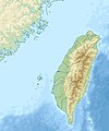
Fichier:Taiwan relief location map.jpg

Taille de cet aperçu : 498 × 599 pixels. Autres résolutions : 199 × 240 pixels | 399 × 480 pixels | 1 016 × 1 222 pixels.
Fichier d’origine (1 016 × 1 222 pixels, taille du fichier : 101 kio, type MIME : image/jpeg)
Historique du fichier
Cliquer sur une date et heure pour voir le fichier tel qu'il était à ce moment-là.
| Date et heure | Vignette | Dimensions | Utilisateur | Commentaire | |
|---|---|---|---|---|---|
| actuel | 19 septembre 2019 à 16:01 |  | 1 016 × 1 222 (101 kio) | Geographyinitiative | temporary fix: extending the boundary out around Dongyin Township (as in China Fujian2 location map.svg and as in File:Nationalist China - administrative divisons. LOC 2007633622.jpg) |
| 3 août 2019 à 19:09 |  | 1 016 × 1 222 (537 kio) | NordNordWest | border corrections | |
| 3 août 2019 à 03:51 |  | 1 016 × 1 222 (96 kio) | Geographyinitiative | Proposed removal of three dashes (markers of the approximate PRC/ROC maritime boundary) which seemed to put Dadan Island, Erdan Island and Binlang Islet (檳榔嶼) outside the territory of Kinmen County, Taiwan/ROC. This is not the optimal form of the map, but is merely a quick removal of incorrect information. In the optimal situation, the line needs to be redrawn in the correct location, but I don't have the technical skill to produce such a map. (Basis: [http://ws.mac.gov.tw/001/Upload/OldFile/... | |
| 3 août 2019 à 02:30 |  | 1 016 × 1 222 (96 kio) | Geographyinitiative | Proposed removal of two dashes (markers of the approximate PRC/ROC maritime boundary) which seemed to put {{w|Dadan Island}} and {{w|Erdan Island}} outside the territory of {{w|Kinmen County}}, Taiwan/ROC. | |
| 28 décembre 2010 à 19:22 |  | 1 016 × 1 222 (452 kio) | Uwe Dedering | {{Information |Description={{en|1=Relief location map of Taiwan. * Projection: Equirectangular projection, strechted by 110.0%. * Geographic limits of the map: :* N: 26.4° N :* S: 21.7° N :* W: 118.0° E :* E: 122.3° E * GMT projection: -JX17.204266666 |
Utilisation du fichier
Les 87 pages suivantes utilisent ce fichier :
- Baisha (Pescadores)
- Baisha (île)
- Banque centrale de la république de Chine
- Bataille de Tamsui
- Bataille de la baie de Liaoluo
- Bataille des Pescadores
- Beinan
- Campagne de Keelung
- Campagne des Pescadores (1885)
- Campagne des Pescadores (1895)
- Cap Eluanbi
- Cap Fugui
- Cap Santiago (Taïwan)
- Centrale d'Hsinta
- Centrale de Hoping
- Centrale de Mailiao
- Centrale de Nanpu
- Centrale de Tatan
- Centrale de Tunghsiao
- Centrale nucléaire de Chin Shan
- Centrale nucléaire de Kuosheng
- Centrale nucléaire de Lungmen
- Centrale nucléaire de Ma'anshan
- Centrale thermique de Taichung
- Daqiu
- Deaflympics d'été de 2009
- Détroit de Taïwan
- Exercices militaires chinois de 2022 autour de Taïwan
- Grotte de la Beauté
- Grotte du homard
- Grotte du nain noir
- Incident du Nerbudda
- Kinmen
- Lac Chenching
- Lac du Soleil et de la Lune
- Lamay
- Lanyu
- Lieyu
- Mont Xiuguluan
- Mont Yuntai (Matsu)
- Parc national de Kenting
- Parc national de Taroko
- Parc national de Yangmingshan
- Penghu (île principale)
- Qimei
- Qixingyan (Taïwan)
- Raid sur Taipei en 1945
- Siège de Fort Zeelandia
- Séisme de 1999 à Chichi
- Séisme de 2016 à Taïwan
- Séisme de 2018 à Hualien
- Séisme de 2024 à Hualien
- Taïwan (île)
- Vase Rock
- Wang'an
- Wuqiu
- Xiyu (Pescadores)
- Yehliu
- Yu Shan
- Île Dacang
- Île Dadan
- Île Erdan
- Île Gupo
- Île Jibei
- Île Kaoteng
- Île Liang
- Île Mudou
- Île Niao
- Île Verte (Taïwan)
- Île Xianjiao
- Île Yuanbei
- Île Zhongtun
- Île de la Montagne Tortue
- Îles Pescadores
- Îlot Fuhsing
- Îlot Hua
- Îlot Jiangong
- Îlot Keelung
- Îlot Menghu
- Îlot Pengjia
- Îlot de la tortue (Matsu)
- Îlot du Lion
- Îlots Zhutai
- Utilisatrice:TokihikoH11/Brouillon
- Modèle:Géolocalisation/Taïwan
- Projet:Cartographie/Géolocalisation/Maintenance/Images des pays
- Module:Carte/données/taïwan
Usage global du fichier
Les autres wikis suivants utilisent ce fichier :
- Utilisation sur ar.wikipedia.org
- Utilisation sur ast.wikipedia.org
- Utilisation sur az.wikipedia.org
- Utilisation sur ba.wikipedia.org
- Utilisation sur bcl.wikipedia.org
- Utilisation sur be.wikipedia.org
- Utilisation sur bn.wikipedia.org
- Utilisation sur bs.wikipedia.org
- Utilisation sur ceb.wikipedia.org
- Utilisation sur ce.wikipedia.org
- Utilisation sur ckb.wikipedia.org
- Utilisation sur de.wikipedia.org
- Utilisation sur de.wikivoyage.org
Voir davantage sur l’utilisation globale de ce fichier.

