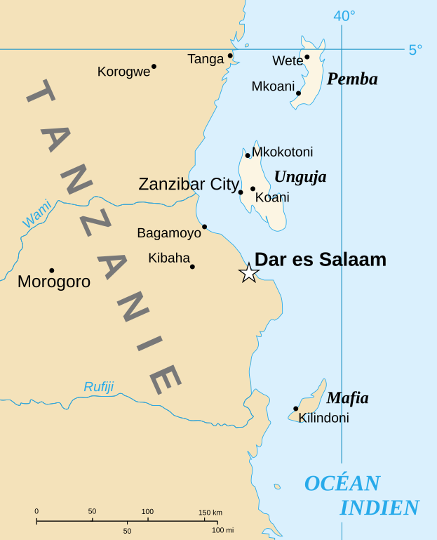
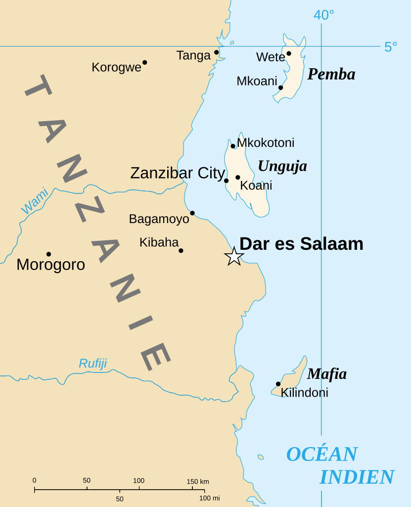
Fichier:Spice Islands-Zanzibar highlighted-fr.svg

Taille de cet aperçu PNG pour ce fichier SVG : 486 × 599 pixels. Autres résolutions : 195 × 240 pixels | 389 × 480 pixels | 623 × 768 pixels | 831 × 1 024 pixels | 1 661 × 2 048 pixels | 713 × 879 pixels.
Fichier d’origine (Fichier SVG, nominalement de 713 × 879 pixels, taille : 24 kio)
Ce fichier et sa description proviennent de Wikimedia Commons.
Description
| Description |
English: Part of the map of Tanzania in French, showing the Spice Islands. Français : Détail de la carte de Tanzanie en français montrant l'archipel de Zanzibar. |
| Date | of the translation : July 2007 |
| Source | Image:Spice Islands (Zanzibar highlighted).svg created by Mysid |
| Auteur | of the translation : Sting |
| Autorisation (Réutilisation de ce fichier) |
PD |
| Autres versions |
Image:Spice_Islands_Tanzania-fr.svg in English : Image:Spice Islands (Tanzania).svg in English : Image:Spice Islands (Zanzibar highlighted).svg |
.svg)
.svg)

|
Ce fichier SVG contient du texte encapsulé pouvant facilement être traduit dans votre langue en utilisant n'importe quel éditeur de fichier SVG ou de texte, ou par l'outil de traduction de fichiers SVG. Pour plus d'informations, voir : A propos de la traduction des fichiers SVG. |
Conditions d’utilisation
| Moi, propriétaire des droits d’auteur sur cette œuvre, la place dans le domaine public. Ceci s'applique dans le monde entier. Dans certains pays, ceci peut ne pas être possible ; dans ce cas : J’accorde à toute personne le droit d’utiliser cette œuvre dans n’importe quel but, sans aucune condition, sauf celles requises par la loi. |
| This work was previously under Public Domain, or a Free License. It has been digitally enhanced and/or modified. This derivative work has been (or is hereby) released into the public domain by its author, Sting at the French Wikipedia project. This applies worldwide. In some countries this is not legally possible; if so:
|
Historique du fichier
Cliquer sur une date et heure pour voir le fichier tel qu'il était à ce moment-là.
| Date et heure | Vignette | Dimensions | Utilisateur | Commentaire | |
|---|---|---|---|---|---|
| actuel | 6 juillet 2007 à 15:31 | | 713 × 879 (24 kio) | Sting | {{Information |Description={{en|Part of the map of Tanzania in French, showing the Spice Islands.}}{{fr|Détail de la carte de Tanzanie en français montrant l'archipel de Zanzibar.}} |Source=[[:Image:Spice |
Utilisation du fichier
Les 9 pages suivantes utilisent ce fichier :
Usage global du fichier
Les autres wikis suivants utilisent ce fichier :
- Utilisation sur el.wikipedia.org
- Utilisation sur en.wikipedia.org
- Utilisation sur es.wikipedia.org
- Utilisation sur uk.wikipedia.org
- Utilisation sur zh.wikipedia.org