Fichier:Moldova Transnistria locator.svg

Taille de cet aperçu PNG pour ce fichier SVG : 488 × 600 pixels. Autres résolutions : 195 × 240 pixels | 390 × 480 pixels | 625 × 768 pixels | 833 × 1 024 pixels | 1 666 × 2 048 pixels | 990 × 1 217 pixels.
Fichier d’origine (Fichier SVG, nominalement de 990 × 1 217 pixels, taille : 190 kio)
Ce fichier et sa description proviennent de Wikimedia Commons.
Description
| Description |
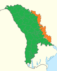
English: Location of Moldova and de facto Transnistria |
||
| Date | |||
| Source | Transnistria in Moldova (de-facto).svg | ||
| Auteur |
|
||
| Autorisation (Réutilisation de ce fichier) |
|
||
| Autres versions | Moldova Transnistria locator.png |
.svg)
Historique du fichier
Cliquer sur une date et heure pour voir le fichier tel qu'il était à ce moment-là.
| Date et heure | Vignette | Dimensions | Utilisateur | Commentaire | |
|---|---|---|---|---|---|
| actuel | 8 janvier 2020 à 15:49 | | 990 × 1 217 (190 kio) | Hogweard | {{Information |description={{en|1=Location of Moldova and de facto Transnistria}} |date=2020-01-08 |source={{f|Transnistria in Moldova (de-facto).svg}} |author=*{{f|Transnistria in Moldova (de-facto).svg}}: {{u|TUBS}} *Derivative work: {{u|Hogweard}} |permission={{PD-self}} |other versions={{f|Moldova Transnistria locator.png}} }} Category:Maps of Moldova Category:Bilateral maps of Moldova Category:Maps of Transnistria Category:Bilateral maps of Transnistria |
Utilisation du fichier
La page suivante utilise ce fichier :
Usage global du fichier
Les autres wikis suivants utilisent ce fichier :
- Utilisation sur el.wiktionary.org
- Utilisation sur en.wikipedia.org
- Utilisation sur ro.wikipedia.org