Fichier:Earth from Space.jpg
Taille de cet aperçu : 600 × 600 pixels. Autres résolutions : 240 × 240 pixels | 480 × 480 pixels | 768 × 768 pixels | 1 024 × 1 024 pixels | 2 048 × 2 048 pixels | 4 096 × 4 096 pixels.
Fichier d’origine (4 096 × 4 096 pixels, taille du fichier : 1,84 Mio, type MIME : image/jpeg)
Ce fichier et sa description proviennent de Wikimedia Commons.
Description
| Description |
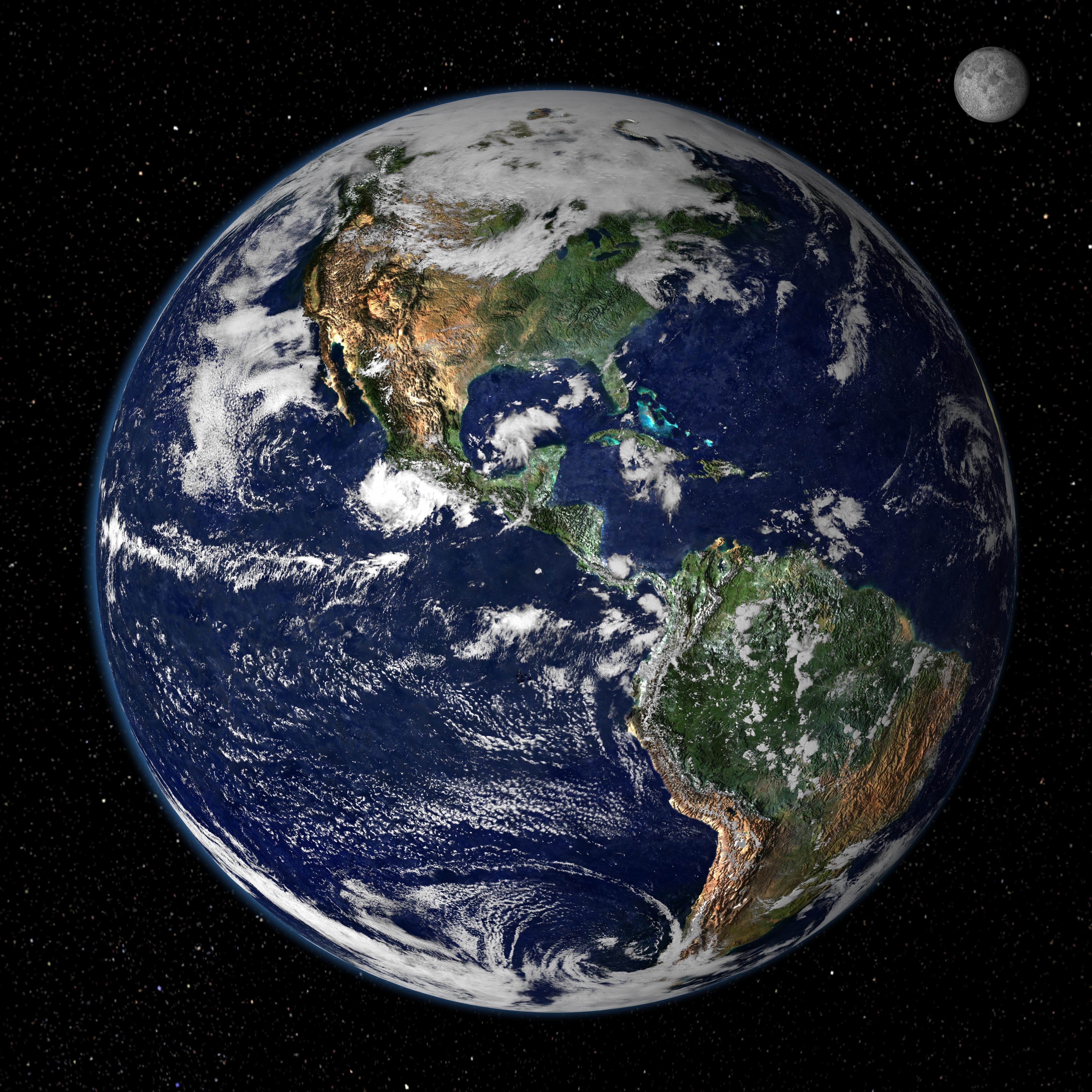
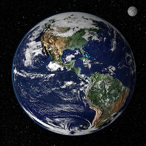
English: This true-color image shows North and South America as they would appear from space 35,000 km (22,000 miles) above the Earth. The image is a combination of data from two satellites. The Moderate Resolution Imaging Spectroradiometer (MODIS) instrument aboard NASA’s Terra satellite collected the land surface data over 16 days, while NOAA’s Geostationary Operational Environmental Satellite (GOES) produced a snapshot of the Earth’s clouds. |
| Date | |
| Source | http://earthobservatory.nasa.gov/IOTD/view.php?id=885 |
| Auteur | NASA/GSFC/Reto Stöckli, Nazmi El Saleous, and Marit Jentoft-Nilsen |
Conditions d’utilisation
| Ce fichier provient de la NASA. Sauf exception, les documents créés par la NASA ne sont pas soumis à copyright. Pour plus d'informations, voir la politique de copyright de la NASA. | ||
 |
Attention :
|
Historique du fichier
Cliquer sur une date et heure pour voir le fichier tel qu'il était à ce moment-là.
| Date et heure | Vignette | Dimensions | Utilisateur | Commentaire | |
|---|---|---|---|---|---|
| actuel | 14 août 2007 à 15:02 | | 4 096 × 4 096 (1,84 Mio) | Shizhao | from http://earthobservatory.nasa.gov/Newsroom/NewImages/images.php3?img_id=4231 This true-color image shows North and South America as they would appear from space 35,000 km (22,000 miles) above the Earth. The image is a combination of data from two sat |
Utilisation du fichier
La page suivante utilise ce fichier :
Usage global du fichier
Les autres wikis suivants utilisent ce fichier :
- Utilisation sur bs.wikipedia.org
- Utilisation sur de.wikiquote.org
- Utilisation sur en.wikipedia.org
- Utilisation sur en.wikiquote.org
- Utilisation sur en.wikiversity.org
- Utilisation sur sv.wikivoyage.org