Fichier:Xinjiang Internment Map, US-Aus Gov Assessment.jpg
Taille de cet aperçu : 800 × 495 pixels. Autres résolutions : 320 × 198 pixels | 640 × 396 pixels | 1 024 × 634 pixels | 1 280 × 792 pixels | 2 048 × 1 267 pixels.
Fichier d’origine (2 048 × 1 267 pixels, taille du fichier : 150 kio, type MIME : image/jpeg)
Ce fichier et sa description proviennent de Wikimedia Commons.
Description
| Description |
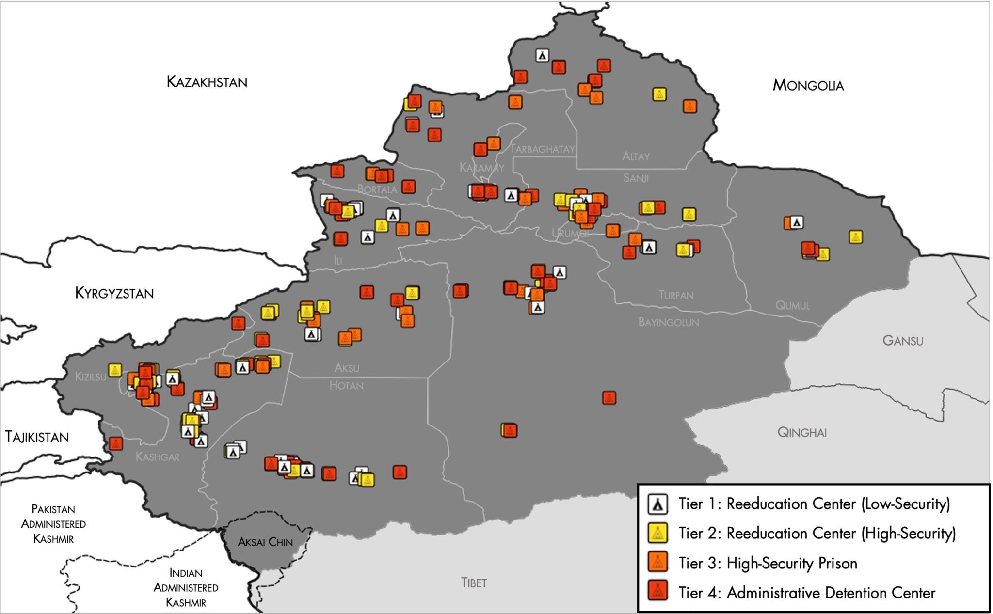
English: Map of the Xinjiang Internment Camps created by the RAND Corporation based on data collected by the US National Geospatial Intelligence Agency and the Australian Strategic Policy Institute. Open source here. |
||||||||
| Date | |||||||||
| Source | https://www.tearline.mil/public_page/xinjiang-nighttime-1/ | ||||||||
| Auteur | National Geospatial Intelligence Agency, using data from the Australian Strategic Policy Institute, and administrative boundaries from GADM. | ||||||||
| Autorisation (Réutilisation de ce fichier) |
|


Historique du fichier
Cliquer sur une date et heure pour voir le fichier tel qu'il était à ce moment-là.
| Date et heure | Vignette | Dimensions | Utilisateur | Commentaire | |
|---|---|---|---|---|---|
| actuel | 2 mai 2021 à 07:05 | | 2 048 × 1 267 (150 kio) | Abovfold | Uploaded a work by {{w|National Geospatial Intelligence Agency}}, using data from the {{w|Australian Strategic Policy Institute}}, and administrative boundaries from {{w|GADM}}. from https://www.tearline.mil/public_page/xinjiang-nighttime-1/ with UploadWizard |
Utilisation du fichier
La page suivante utilise ce fichier :
Usage global du fichier
Les autres wikis suivants utilisent ce fichier :
- Utilisation sur ba.wikipedia.org
- Utilisation sur br.wikipedia.org
- Utilisation sur cs.wikipedia.org
- Utilisation sur de.wikipedia.org
- Utilisation sur el.wikipedia.org
- Utilisation sur en.wikipedia.org
- Utilisation sur es.wikipedia.org
- Utilisation sur fi.wikipedia.org
- Utilisation sur ga.wikipedia.org
- Utilisation sur he.wikipedia.org
- Utilisation sur km.wikipedia.org
- Utilisation sur lv.wikipedia.org
- Utilisation sur nl.wikipedia.org
- Utilisation sur or.wikipedia.org
- Utilisation sur pl.wikipedia.org
- Utilisation sur pt.wikipedia.org
- Utilisation sur ru.wikinews.org
- Utilisation sur sr.wikipedia.org
- Utilisation sur sv.wikipedia.org
- Utilisation sur szl.wikipedia.org
- Utilisation sur tr.wikipedia.org
- Utilisation sur www.wikidata.org