Fichier:Wales Monmouthshire locator map.svg

Taille de cet aperçu PNG pour ce fichier SVG : 502 × 600 pixels. Autres résolutions : 201 × 240 pixels | 402 × 480 pixels | 643 × 768 pixels | 857 × 1 024 pixels | 1 714 × 2 048 pixels | 1 047 × 1 251 pixels.
Fichier d’origine (Fichier SVG, nominalement de 1 047 × 1 251 pixels, taille : 149 kio)
Ce fichier et sa description proviennent de Wikimedia Commons.
Description
| Description |
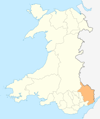
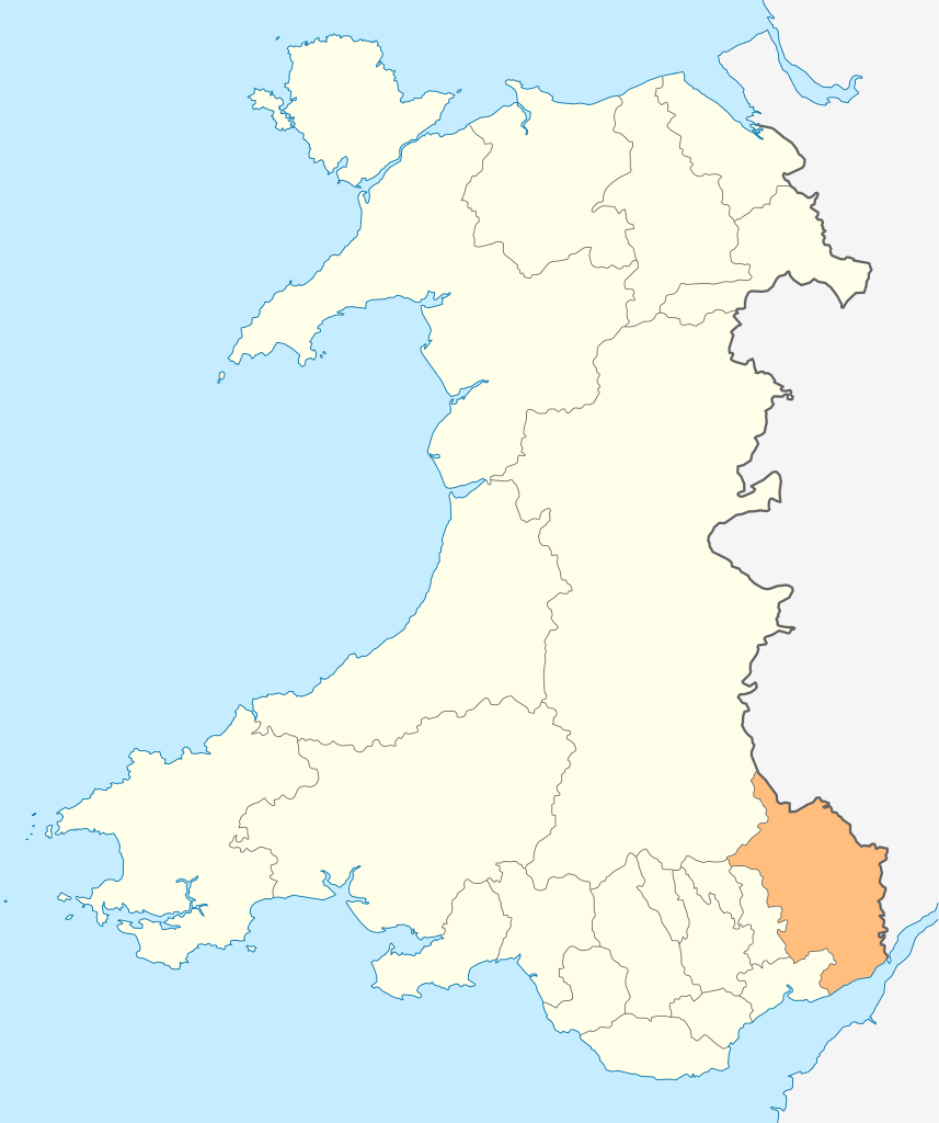
Deutsch: Lagekarte von Monmouthshire in Wales
English: Locator map of Monmouthshire in Wales |
| Date | |
| Source | Travail personnel |
| Auteur | NordNordWest |
| Autorisation (Réutilisation de ce fichier) |
Moi, en tant que détenteur des droits d’auteur sur cette œuvre, je la publie sous la licence suivante : Ce fichier est disponible selon les termes de la licence Creative Commons Attribution – Partage dans les Mêmes Conditions 3.0 (non transposée).
|

|
Cette carte a été créée ou améliorée dans le Kartenwerkstatt (Atelier cartographique allemand). Vous pouvez également y proposer des cartes à améliorer.
|
Historique du fichier
Cliquer sur une date et heure pour voir le fichier tel qu'il était à ce moment-là.
| Date et heure | Vignette | Dimensions | Utilisateur | Commentaire | |
|---|---|---|---|---|---|
| actuel | 4 mai 2010 à 20:54 | | 1 047 × 1 251 (149 kio) | NordNordWest | {{int:filedesc}} {{Information |Description= {{de|Lagekarte von Monmouthshire in Wales}} {{en|Locator map of Monmouthshire in Wales}} |Source={{Own}} |Date=2010-05-04 |Author={{U|NordNordWest}} |Permission={{self|cc-by-sa-3.0}} |other_versions= }} {{Kart |
Utilisation du fichier
Aucune page n’utilise ce fichier.
Usage global du fichier
Les autres wikis suivants utilisent ce fichier :
- Utilisation sur cs.wikipedia.org
- Utilisation sur en.wikipedia.org
- Abergavenny
- Monmouth
- Usk
- Chepstow
- Monmouthshire
- Caldicot
- Caerwent
- Llanelly
- Rogiet
- List of places in Monmouthshire
- Little Mill, Monmouthshire
- Template:Monmouthshire-geo-stub
- Llanbadoc
- Wye Valley
- River Trothy
- Llanarth, Monmouthshire
- Grosmont, Monmouthshire
- Graig Syfyrddin
- Monnow Valley Walk
- Tregare
- Blaina
- Llanddewi Rhydderch
- Ashvale, Blaenau Gwent
- Govilon
- Llantilio Pertholey
- Llanvihangel Gobion
- Llangattock Lingoed
- Llanvihangel-Ystern-Llewern
- Cross Ash
- Bryngwyn
- Cwmcarvan
- Mitchel Troy
- Newbridge-on-Usk
- Mardy, Monmouthshire
- Wolvesnewton
- Llanover
- Llancayo
- Llandenny
- Llanvetherine
- Mamhilad
- Oldcastle, Monmouthshire
- Llantrisant, Monmouthshire
- Llanwenarth
- St Arvans
- Catbrook
- Glascoed
- Llansoy
- St Maughans
- Monkswood, Monmouthshire
Voir davantage sur l’utilisation globale de ce fichier.