Fichier:Victoria Highway map.png
Victoria_Highway_map.png (700 × 457 pixels, taille du fichier : 71 kio, type MIME : image/png)
Ce fichier et sa description proviennent de Wikimedia Commons.
Description
| Description |
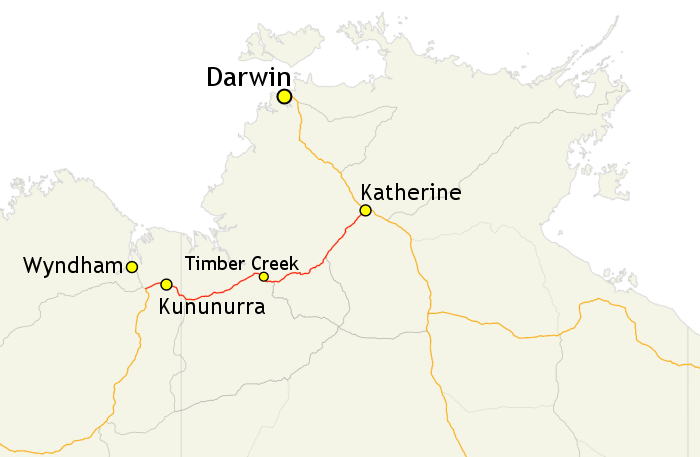
English: Map of Victoria Highway (shown in red) and surrounding road network in north-western Australia. |
| Date | |
| Source |
Travail personnel; |
| Auteur |
Evad37 |
| Autorisation (Réutilisation de ce fichier) |
GIS data: "Save for the content on this website supplied by third parties, the Geoscience Australia logo, the Commonwealth Coat of Arms, and any material protected by a trade mark, Geoscience Australia has applied the Creative Commons Attribution 3.0 Australia licence. Geoscience Australia asserts the right to be recognised as author of the original material in the following manner: |
| Autres versions |
English: Alternate version with route markers (on the English Wikipedia) |
Map created using map data from Geoscience Australia, licensed under the Creative Commons Attribution 3.0 Australia license (CC BY 3.0 AU).
Conditions d’utilisation
- Vous êtes libre :
- de partager – de copier, distribuer et transmettre cette œuvre
- d’adapter – de modifier cette œuvre
- Sous les conditions suivantes :
- paternité – Vous devez donner les informations appropriées concernant l'auteur, fournir un lien vers la licence et indiquer si des modifications ont été faites. Vous pouvez faire cela par tout moyen raisonnable, mais en aucune façon suggérant que l’auteur vous soutient ou approuve l’utilisation que vous en faites.
- partage à l’identique – Si vous modifiez, transformez, ou vous basez sur cette œuvre, vous devez distribuer votre contribution sous la même licence ou une licence compatible avec celle de l’original.
Historique du fichier
Cliquer sur une date et heure pour voir le fichier tel qu'il était à ce moment-là.
| Date et heure | Vignette | Dimensions | Utilisateur | Commentaire | |
|---|---|---|---|---|---|
| actuel | 1 juin 2014 à 04:19 | | 700 × 457 (71 kio) | Evad37 | {{Information |description={{en|1=Map of Victoria Highway (shown in red) and surrounding road network in north-western Australia.}} |date=2014-06-01 |source={{own}};<br/> '''GIS data sources:''' Geoscience Australia |author=Evad37<br/>... |
Utilisation du fichier
La page suivante utilise ce fichier :
Usage global du fichier
Les autres wikis suivants utilisent ce fichier :
- Utilisation sur de.wikipedia.org
- Utilisation sur www.wikidata.org