Fichier:USGS map of Sabine Pass.jpg
Taille de cet aperçu : 467 × 599 pixels. Autres résolutions : 187 × 240 pixels | 374 × 480 pixels | 599 × 768 pixels | 798 × 1 024 pixels | 1 500 × 1 924 pixels.
Fichier d’origine (1 500 × 1 924 pixels, taille du fichier : 900 kio, type MIME : image/jpeg)
Ce fichier et sa description proviennent de Wikimedia Commons.
Description
| Description |
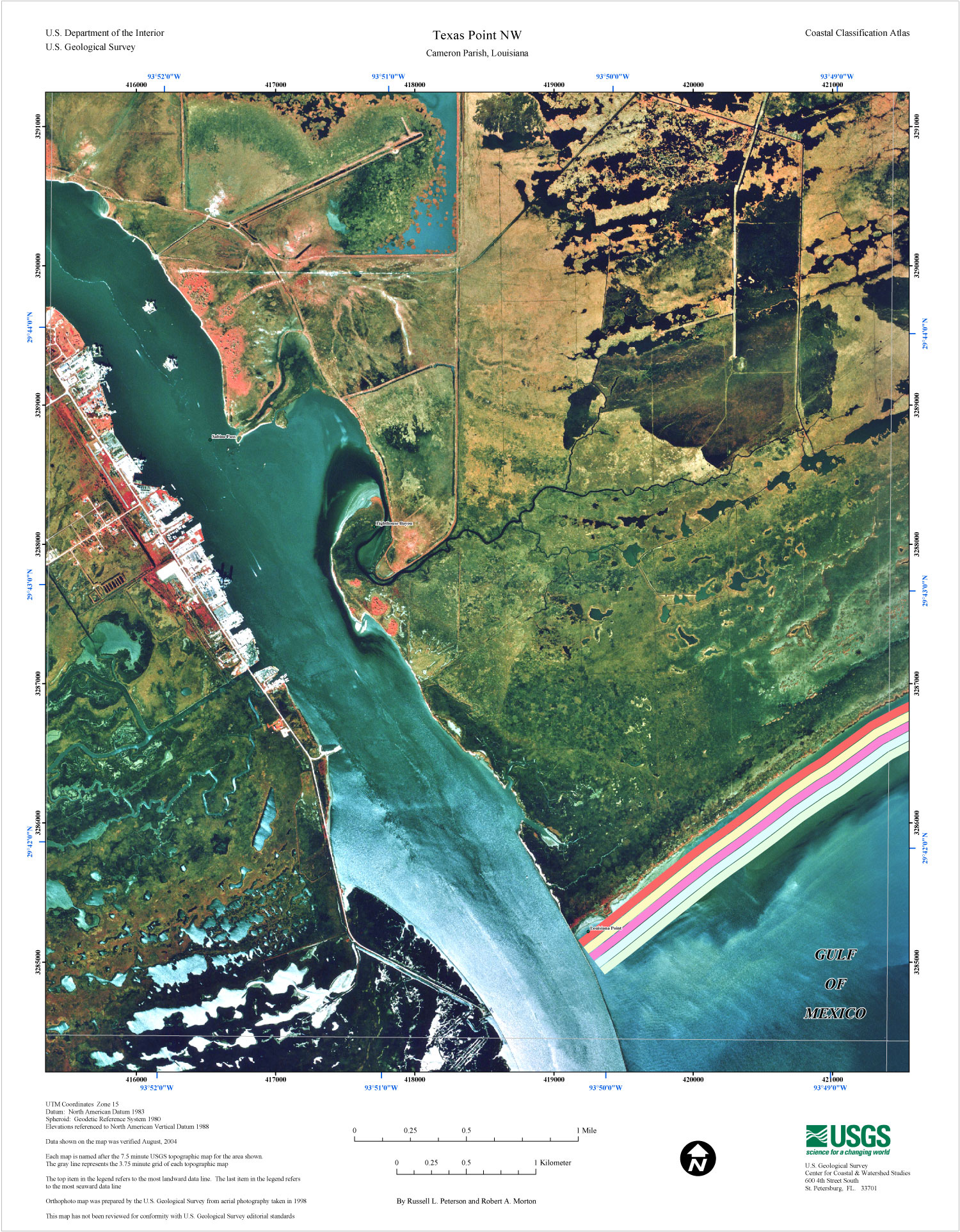
English: USGS map of Sabine Pass at the border of Texas and Louisiana, 2004. Orthophoto map was prepared by the U.S. Geological Survey from aerial photography taken in 1998 |
| Date | |
| Source | https://pubs.usgs.gov/of/2005/1261/texas-pointNW.html |
| Auteur | USGS |
Conditions d’utilisation
Cette image est placée dans le domaine public parce qu'elle contient des éléments issus de l'United States Geological Survey, une agence du Département de l'Intérieur des États-Unis. Pour plus d'information, consultez la politique officielle de copyright de l'USGS (en anglais)
|
Historique du fichier
Cliquer sur une date et heure pour voir le fichier tel qu'il était à ce moment-là.
| Date et heure | Vignette | Dimensions | Utilisateur | Commentaire | |
|---|---|---|---|---|---|
| actuel | 27 août 2020 à 00:07 | | 1 500 × 1 924 (900 kio) | Diannaa | bigger version, from same source |
| 26 juin 2006 à 07:02 |  | 416 × 534 (85 kio) | Johntex~commonswiki | USGS map of Sabine Pass at the border of Texas and Louisiana. Uploaded by Johntex Category:Texas Category:Louisiana Category:Maps |
Utilisation du fichier
Les 3 pages suivantes utilisent ce fichier :
Usage global du fichier
Les autres wikis suivants utilisent ce fichier :
- Utilisation sur ar.wikipedia.org
- Utilisation sur ceb.wikipedia.org
- Utilisation sur en.wikipedia.org
- Utilisation sur id.wikipedia.org
- Utilisation sur it.wikipedia.org
- Utilisation sur www.wikidata.org