Fichier:Trinidad and Tobago map.png
Taille de cet aperçu : 523 × 600 pixels. Autres résolutions : 209 × 240 pixels | 419 × 480 pixels | 998 × 1 144 pixels.
Fichier d’origine (998 × 1 144 pixels, taille du fichier : 213 kio, type MIME : image/png)
Ce fichier et sa description proviennent de Wikimedia Commons.
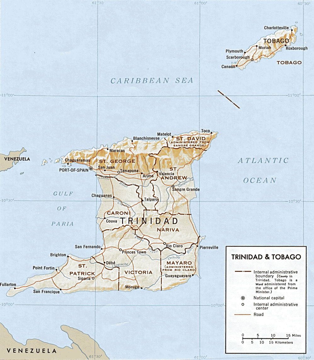
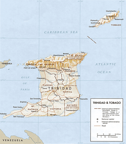
| Description | Map of Trinidad and Tobago | |||
| Date | ||||
| Source | http://www.lib.utexas.edu/maps/americas.html | |||
| Auteur | CIA | |||
| Autorisation (Réutilisation de ce fichier) |
|
|||
| Autres versions | Œuvres dérivées de ce fichier : Range of Poecilia obscura.png |

Historique du fichier
Cliquer sur une date et heure pour voir le fichier tel qu'il était à ce moment-là.
| Date et heure | Vignette | Dimensions | Utilisateur | Commentaire | |
|---|---|---|---|---|---|
| actuel | 17 mars 2009 à 04:23 | | 998 × 1 144 (213 kio) | Sasha Krotov | {{Information |Description=Map of Trinidad and Tobago |Source=http://www.lib.utexas.edu/maps/americas.html |Date=1969 |Author=CIA |Permission={{PD-USGov-CIA}} |other_versions= }} Category:Maps of Trinidad and Tobago <!--{{ImageUpload|basic}}--> |
Utilisation du fichier
La page suivante utilise ce fichier :
Usage global du fichier
Les autres wikis suivants utilisent ce fichier :
- Utilisation sur en.wikipedia.org