Fichier:Thatched Cottage and Maypole - geograph.org.uk - 314401.jpg
Pas de plus haute résolution disponible.
Thatched_Cottage_and_Maypole_-_geograph.org.uk_-_314401.jpg (640 × 480 pixels, taille du fichier : 124 kio, type MIME : image/jpeg)
Ce fichier et sa description proviennent de Wikimedia Commons.
Description
| Description |
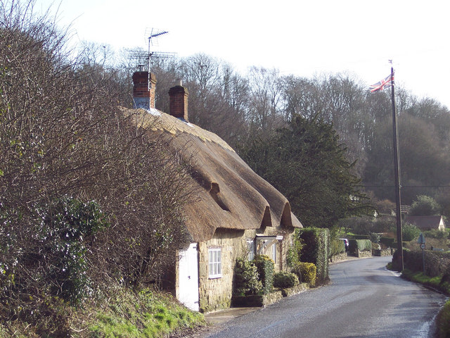
English: Thatched Cottage and Maypole Ansty is a very picturesque village with a large pond surrounded by the Manor House, cottages and ancient Commandery.
It has been the scene of May Day gatherings for over 1,000 years. The Maypole itself was a gift from the Arundells of Wardour Castle and replaced every twenty years - the present one is keeping with earlier tradition, still has a silver coin lodged beneath the weather vane. It is said that whoever is brave enough or foolhardy enough to climb the pole can keep it. Originally, tenants of the Wardour estate brought their children to meet each other and dance around the maypole every year. This gathering has continued annually for hundreds of years, except during 1644 to 1660 when Puritan officials removed the pole by government statute. |
| Date | |
| Source | From geograph.org.uk |
| Auteur | Trish Steel |
| Lieu de la prise de vue | | Voir cet endroit et d’autres images sur : OpenStreetMap |
|---|
_heading:135.00&language=fr)
| Position de l'objet | | Voir cet endroit et d’autres images sur : OpenStreetMap |
|---|
_heading:135.00&language=fr)
Conditions d’utilisation

|
Cette image provient de la collection du projet Geograph British Isles. Pour obtenir les coordonnées du photographe, veuillez consulter cette page de description de l'image sur le site du projet. Les droits d'auteurs sur cette image sont détenus par Trish Steel ; l'image est placée sous une licence Creative Commons avec mention de paternité et partage à l'identique (CC-By-SA) en version 2.0.
|
Ce fichier est disponible selon les termes de la licence Creative Commons Attribution – Partage dans les Mêmes Conditions 2.0 Générique
Attribution: Trish Steel
- Vous êtes libre :
- de partager – de copier, distribuer et transmettre cette œuvre
- d’adapter – de modifier cette œuvre
- Sous les conditions suivantes :
- paternité – Vous devez donner les informations appropriées concernant l'auteur, fournir un lien vers la licence et indiquer si des modifications ont été faites. Vous pouvez faire cela par tout moyen raisonnable, mais en aucune façon suggérant que l’auteur vous soutient ou approuve l’utilisation que vous en faites.
- partage à l’identique – Si vous modifiez, transformez, ou vous basez sur cette œuvre, vous devez distribuer votre contribution sous la même licence ou une licence compatible avec celle de l’original.
Historique du fichier
Cliquer sur une date et heure pour voir le fichier tel qu'il était à ce moment-là.
| Date et heure | Vignette | Dimensions | Utilisateur | Commentaire | |
|---|---|---|---|---|---|
| actuel | 30 décembre 2010 à 17:53 | | 640 × 480 (124 kio) | GeographBot | == {{int:filedesc}} == {{Information |description={{en|1=Thatched Cottage and Maypole Ansty is a very picturesque village with a large pond surrounded by the Manor House, cottages and ancient Commandery. It has been the scene of May Day gatherings for |
Utilisation du fichier
La page suivante utilise ce fichier :
Usage global du fichier
Les autres wikis suivants utilisent ce fichier :
- Utilisation sur ceb.wikipedia.org
- Utilisation sur en.wikipedia.org
- Utilisation sur lld.wikipedia.org
- Utilisation sur pl.wikipedia.org
- Utilisation sur www.wikidata.org
- Utilisation sur zh-min-nan.wikipedia.org