Fichier:Tetiaroa.jpg
Fichier d’origine (617 × 668 pixels, taille du fichier : 111 kio, type MIME : image/jpeg)
Ce fichier et sa description proviennent de Wikimedia Commons.
Description
http://www.lib.utexas.edu/maps/historical/pacific_islands_1943_1945/tetiaroa.jpg
Public domain, as explained on page http://www.lib.utexas.edu/usage_statement.html?maps=yes: "Most of the maps scanned by the University of Texas Libraries and served from this web site are in the public domain. No permissions are needed to copy them. You may download them and use them as you wish. A few maps are copyrighted, and are clearly marked as such."
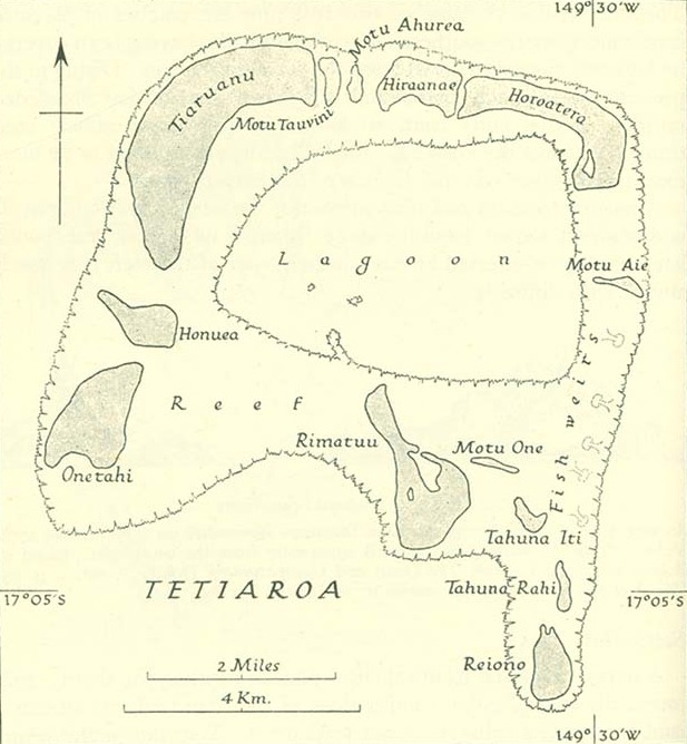
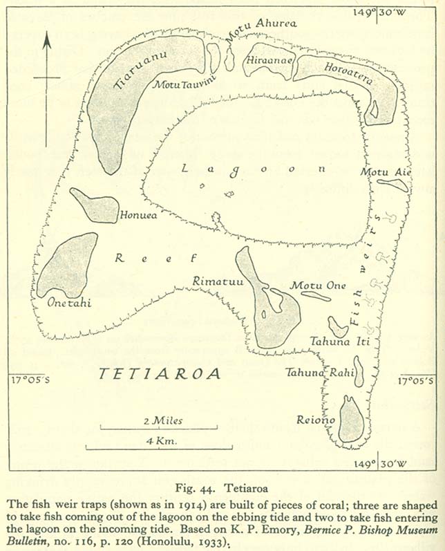
The motu of Tahuna Iti and the sandbank of Motu One are interchanged on the map.
Conditions d’utilisation
Ce fichier est dans le domaine public, parce que it has been taken from a collection of public domain maps at the University of Texas Library''
Si cela n'est pas légalement possible : Veuillez vérifier que la raison donnée est compatible avec la politique de licences de Commons.
|
Historique du fichier
Cliquer sur une date et heure pour voir le fichier tel qu'il était à ce moment-là.
| Date et heure | Vignette | Dimensions | Utilisateur | Commentaire | |
|---|---|---|---|---|---|
| actuel | 18 janvier 2014 à 10:00 | | 617 × 668 (111 kio) | Cropbot | upload cropped version, operated by User:Andy king50. Summary: cropped |
| 21 octobre 2006 à 17:23 |  | 644 × 797 (92 kio) | Ratzer | http://www.lib.utexas.edu/maps/historical/pacific_islands_1943_1945/tetiaroa.jpg Public domain, as explained on page http://www.lib.utexas.edu/usage_statement.html?maps=yes: "Most of the maps scanned by the University of Texas Libraries and served from t |
Utilisation du fichier
La page suivante utilise ce fichier :
Usage global du fichier
Les autres wikis suivants utilisent ce fichier :
- Utilisation sur als.wikipedia.org
- Utilisation sur az.wikipedia.org
- Utilisation sur ca.wikipedia.org
- Utilisation sur de.wikipedia.org
- Utilisation sur en.wikipedia.org
- Utilisation sur eo.wikipedia.org
- Utilisation sur es.wikipedia.org
- Utilisation sur gl.wikipedia.org
- Utilisation sur hu.wikipedia.org
- Utilisation sur mk.wikipedia.org
- Utilisation sur no.wikipedia.org
- Utilisation sur pl.wikipedia.org
- Utilisation sur pt.wikipedia.org
- Utilisation sur ru.wikipedia.org
- Utilisation sur sv.wikipedia.org
- Utilisation sur zh.wikipedia.org