Fichier:SiegeOfQuebec1759ByDesBarres.jpg

Taille de cet aperçu : 800 × 386 pixels. Autres résolutions : 320 × 154 pixels | 640 × 309 pixels | 1 024 × 494 pixels | 1 280 × 617 pixels | 2 560 × 1 234 pixels | 6 854 × 3 304 pixels.
Fichier d’origine (6 854 × 3 304 pixels, taille du fichier : 8,58 Mio, type MIME : image/jpeg)
Ce fichier et sa description proviennent de Wikimedia Commons.
Description
| Description |
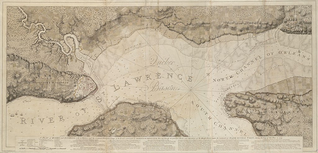
English: This is a map depicting the troop arrangements at the 1759 Siege of Quebec. The caption reads: A Plan of Quebec and Environs, with its Defenses and the occasional entrenched Camps of the French commanded by Marquis de Montcalme; shewing likewise the principal Works and Operations of the British Forces, under the command of Major General Wolfe, during the Siege of that Place in 1759.
Français : Cette carte montre la disposition des troupes durant le Siège de Québec de 1759. |
| Date | published 1777 |
| Source | Call Number: G1106.P5 1777 .D4 |
| Auteur | Joseph F. W. Des Barres |
Conditions d’utilisation
Ce document est dans le domaine public aux États-Unis. Ceci s'applique aux travaux des États-Unis où le copyright a expiré, souvent parce que sa première publication s'est produite avant le 1er janvier 1929. Voir cette page pour davantage d'explication.
|
 | |
 |
Cette image peut ne pas être dans le domaine public en dehors des États-Unis (ceci s'applique particulièrement au Canada, en Chine (pas Hong Kong, Macao, ni Taïwan), en Allemagne ou en Suisse). Le créateur et l'année de la publication sont l'information essentielle et doivent être fournis.
|
Historique du fichier
Cliquer sur une date et heure pour voir le fichier tel qu'il était à ce moment-là.
| Date et heure | Vignette | Dimensions | Utilisateur | Commentaire | |
|---|---|---|---|---|---|
| actuel | 25 juillet 2009 à 04:21 | | 6 854 × 3 304 (8,58 Mio) | Magicpiano | {{Information |Description={{en|1=This is a map depicting the troop arrangements at the 1759 Siege of Quebec. The caption reads: A Plan of Quebec and Environs, with its Defenses and the occasional entrenched Camps of the Fren |
Utilisation du fichier
Les 7 pages suivantes utilisent ce fichier :
Usage global du fichier
Les autres wikis suivants utilisent ce fichier :
- Utilisation sur ca.wikipedia.org
- Utilisation sur de.wikipedia.org
- Utilisation sur en.wikipedia.org
- Utilisation sur es.wikipedia.org
- Utilisation sur it.wikipedia.org
- Utilisation sur nn.wikipedia.org
- Utilisation sur ru.wikipedia.org
- Utilisation sur uk.wikipedia.org
- Utilisation sur www.wikidata.org