Fichier:Saint Lucia district of Vieux Fort.svg

Taille de cet aperçu PNG pour ce fichier SVG : 215 × 402 pixels. Autres résolutions : 128 × 240 pixels | 256 × 480 pixels | 411 × 768 pixels | 547 × 1 024 pixels | 1 095 × 2 048 pixels.
Fichier d’origine (Fichier SVG, nominalement de 215 × 402 pixels, taille : 130 kio)
Ce fichier et sa description proviennent de Wikimedia Commons.
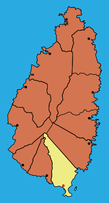
| Description | Map of the district Vieux Fort in Saint Lucia |
| Date | |
| Source |
|
| Auteur | MorbZ |
| Autres versions |
|

Moi, en tant que détenteur des droits d’auteur sur cette œuvre, je la publie sous la licence suivante :
Ce fichier est sous licence Creative Commons Attribution – Partage dans les Mêmes Conditions 2.5 Générique, 2.0 Générique et 1.0 Générique.
- Vous êtes libre :
- de partager – de copier, distribuer et transmettre cette œuvre
- d’adapter – de modifier cette œuvre
- Sous les conditions suivantes :
- paternité – Vous devez donner les informations appropriées concernant l'auteur, fournir un lien vers la licence et indiquer si des modifications ont été faites. Vous pouvez faire cela par tout moyen raisonnable, mais en aucune façon suggérant que l’auteur vous soutient ou approuve l’utilisation que vous en faites.
- partage à l’identique – Si vous modifiez, transformez, ou vous basez sur cette œuvre, vous devez distribuer votre contribution sous la même licence ou une licence compatible avec celle de l’original.
Historique du fichier
Cliquer sur une date et heure pour voir le fichier tel qu'il était à ce moment-là.
| Date et heure | Vignette | Dimensions | Utilisateur | Commentaire | |
|---|---|---|---|---|---|
| actuel | 22 juin 2009 à 15:53 | | 215 × 402 (130 kio) | MorbZ | less water, different lines |
| 22 juin 2009 à 02:15 |  | 295 × 427 (191 kio) | MorbZ | {{Information |Description=Map of the district Vieux Fort in Saint Lucia |Source= *Border of the Island: [http://openstreetmap.org Openstreetmap] *Borders of Districts: File:Saint Lucia geography map en.png *Towns: [http://www.citypopulation.de/StLu |
Utilisation du fichier
La page suivante utilise ce fichier :
Usage global du fichier
Les autres wikis suivants utilisent ce fichier :
- Utilisation sur el.wikipedia.org
- Utilisation sur es.wikipedia.org
- Utilisation sur tr.wikipedia.org
- Utilisation sur www.wikidata.org