Fichier:Rainfall of Matthew in the Caribbean.jpg
Taille de cet aperçu : 800 × 450 pixels. Autres résolutions : 320 × 180 pixels | 640 × 360 pixels | 1 280 × 720 pixels.
Fichier d’origine (1 280 × 720 pixels, taille du fichier : 222 kio, type MIME : image/jpeg)
Ce fichier et sa description proviennent de Wikimedia Commons.
Description
| Description |
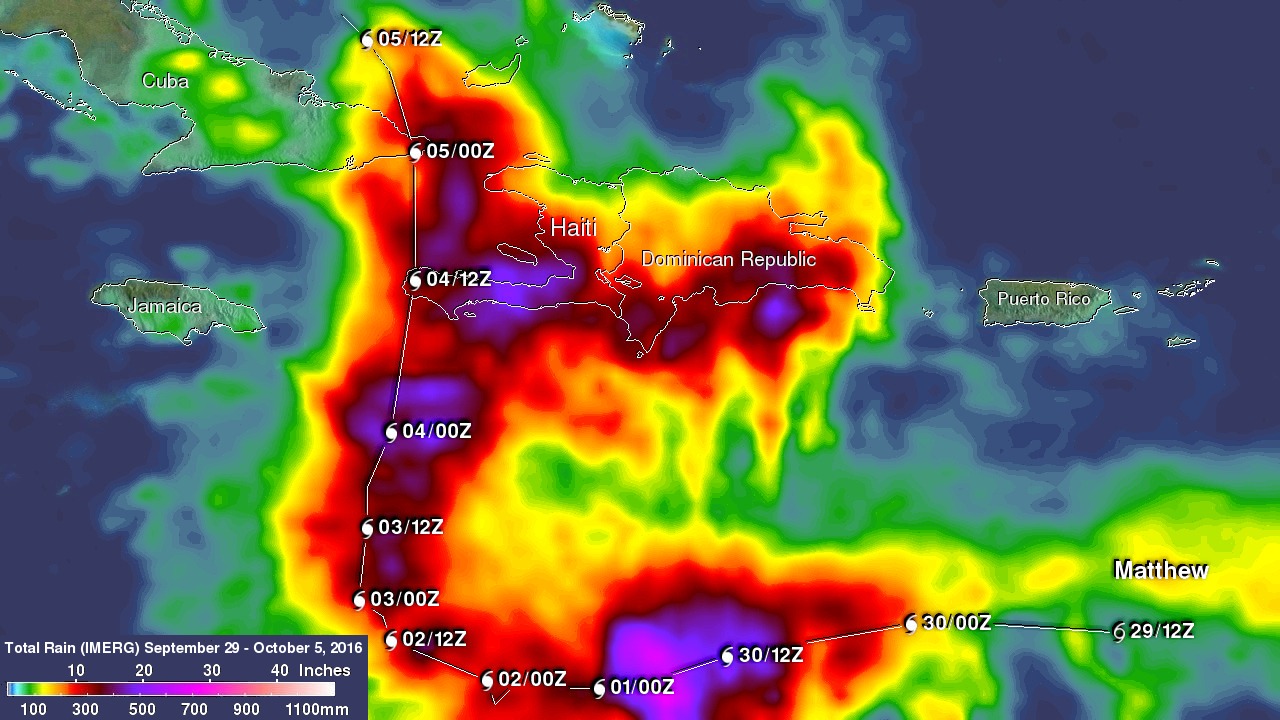
English: This image shows IMERG rainfall estimates for the period September 29 to October 5, 2016 for the northeastern Caribbean in association with the passage of Hurricane Matthew, which is indicated by the white line and corresponding storm symbols. Beginning at 00 UTC on the Sept. 30, rainfall totals associated with Matthew are in excess of 10 inches all along its track (shown in red), reaching upwards of 25 inches (shown in pink) when the storm was intensifying on Sept. 30. Over land, IMERGE shows wide areas of between 15 to 20 inches of rain (dark red and purple areas, respectively) all along the southern coasts of Haiti and the Dominican Republic on the island of Hispaniola. |
| Date | |
| Source | https://www.nasa.gov/feature/goddard/2016/matthew-atlantic-ocean |
| Auteur | NASA |
Conditions d’utilisation
| Ce fichier provient de la NASA. Sauf exception, les documents créés par la NASA ne sont pas soumis à copyright. Pour plus d'informations, voir la politique de copyright de la NASA. | ||
 |
Attention :
|
Historique du fichier
Cliquer sur une date et heure pour voir le fichier tel qu'il était à ce moment-là.
| Date et heure | Vignette | Dimensions | Utilisateur | Commentaire | |
|---|---|---|---|---|---|
| actuel | 28 février 2018 à 08:14 | | 1 280 × 720 (222 kio) | A1Cafel | User created page with UploadWizard |
Utilisation du fichier
La page suivante utilise ce fichier :