Fichier:Parish church of St Wilfrid, Kirkby - geograph.org.uk - 243700.jpg
Pas de plus haute résolution disponible.
Parish_church_of_St_Wilfrid,_Kirkby_-_geograph.org.uk_-_243700.jpg (640 × 480 pixels, taille du fichier : 108 kio, type MIME : image/jpeg)
Ce fichier et sa description proviennent de Wikimedia Commons.
Description
| Description |
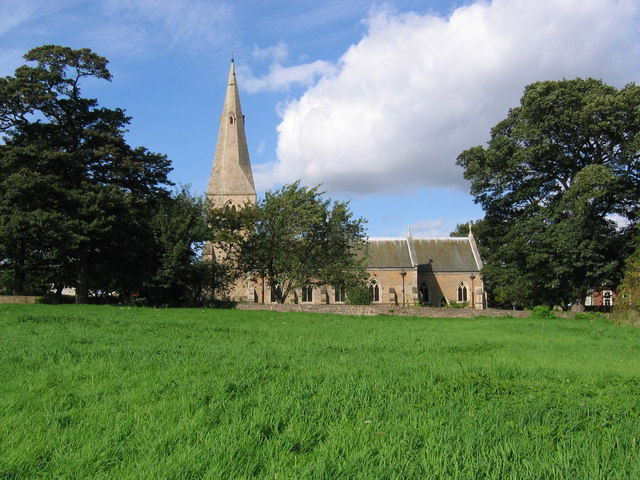
English: Parish church of St Wilfrid, Kirkby. The Church stands on an ancient site dating back to the 6th Century. The church was rebuilt in 1908 following a fire in 1907, which destroyed all but the tower and spire. The photograph was taken from the footpath to the south of the church and the grassy area in the foreground, known as Castle Hill, was the site of Kirkby Castle which pre-dated the Norman Conquest. |
| Date | |
| Source | From geograph.org.uk |
| Auteur | Nikki Mahadevan |
| Attribution (imposé par la licence) | Nikki Mahadevan / Parish church of St Wilfrid, Kirkby / |
| Lieu de la prise de vue | | Voir cet endroit et d’autres images sur : OpenStreetMap |
|---|
_heading:0.00&language=fr)
| Position de l'objet | | Voir cet endroit et d’autres images sur : OpenStreetMap |
|---|
_heading:0.00&language=fr)
Conditions d’utilisation

|
Cette image provient de la collection du projet Geograph British Isles. Pour obtenir les coordonnées du photographe, veuillez consulter cette page de description de l'image sur le site du projet. Les droits d'auteurs sur cette image sont détenus par Nikki Mahadevan ; l'image est placée sous une licence Creative Commons avec mention de paternité et partage à l'identique (CC-By-SA) en version 2.0.
|
Ce fichier est disponible selon les termes de la licence Creative Commons Attribution – Partage dans les Mêmes Conditions 2.0 Générique
Attribution: Nikki Mahadevan
- Vous êtes libre :
- de partager – de copier, distribuer et transmettre cette œuvre
- d’adapter – de modifier cette œuvre
- Sous les conditions suivantes :
- paternité – Vous devez donner les informations appropriées concernant l'auteur, fournir un lien vers la licence et indiquer si des modifications ont été faites. Vous pouvez faire cela par tout moyen raisonnable, mais en aucune façon suggérant que l’auteur vous soutient ou approuve l’utilisation que vous en faites.
- partage à l’identique – Si vous modifiez, transformez, ou vous basez sur cette œuvre, vous devez distribuer votre contribution sous la même licence ou une licence compatible avec celle de l’original.
Historique du fichier
Cliquer sur une date et heure pour voir le fichier tel qu'il était à ce moment-là.
| Date et heure | Vignette | Dimensions | Utilisateur | Commentaire | |
|---|---|---|---|---|---|
| actuel | 1 février 2010 à 18:02 | | 640 × 480 (108 kio) | GeographBot | == {{int:filedesc}} == {{Information |description={{en|1=Parish church of St Wilfrid, Kirkby. The Church stands on an ancient site dating back to the 6th Century. The church was rebuilt in 1908 following a fire in 1907, which destroyed all but the tower a |
Utilisation du fichier
La page suivante utilise ce fichier :
Usage global du fichier
Les autres wikis suivants utilisent ce fichier :
- Utilisation sur en.wikipedia.org
- Utilisation sur www.wikidata.org