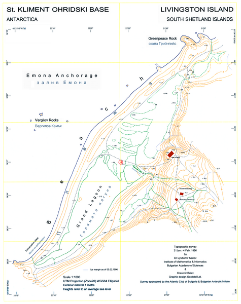
Fichier:Ohridski-Map.PNG

Taille de cet aperçu : 475 × 600 pixels. Autres résolutions : 190 × 240 pixels | 380 × 480 pixels | 608 × 768 pixels | 811 × 1 024 pixels | 1 622 × 2 048 pixels | 2 849 × 3 598 pixels.
Fichier d’origine (2 849 × 3 598 pixels, taille du fichier : 29,38 Mio, type MIME : image/png)
Historique du fichier
Cliquer sur une date et heure pour voir le fichier tel qu'il était à ce moment-là.
| Date et heure | Vignette | Dimensions | Utilisateur | Commentaire | |
|---|---|---|---|---|---|
| actuel | 27 juillet 2010 à 10:25 |  | 2 849 × 3 598 (29,38 Mio) | Apcbg | Decreased size to less than 12.5 million pixels. |
| 27 juillet 2010 à 10:14 |  | 3 561 × 4 497 (3,52 Mio) | Apcbg | A redrawn version of the map. | |
| 23 mai 2009 à 10:58 |  | 2 762 × 3 317 (1,26 Mio) | Apcbg | {{Information |Description={{en|1=L.L. Ivanov, St. Kliment Ohridski Base, Livingston Island, 1:1 000 scale topographic map, Commissioned by the Antarctic Place-names Commission of Bulgaria, sponsored by the Atlantic Club of Bulgaria and the Bulgarian Anta |
Utilisation du fichier
La page suivante utilise ce fichier :
Usage global du fichier
Les autres wikis suivants utilisent ce fichier :
- Utilisation sur bg.wikipedia.org
- Utilisation sur ca.wikipedia.org
- Utilisation sur en.wikipedia.org
- Utilisation sur es.wikipedia.org
- Utilisation sur it.wikipedia.org
- Utilisation sur ja.wikipedia.org
- Utilisation sur mk.wikipedia.org
- Utilisation sur nn.wikipedia.org
- Utilisation sur pt.wikipedia.org