Fichier:NZ-West Coast plain map.png
Pas de plus haute résolution disponible.
NZ-West_Coast_plain_map.png (378 × 423 pixels, taille du fichier : 21 kio, type MIME : image/png)
Ce fichier et sa description proviennent de Wikimedia Commons.
Description
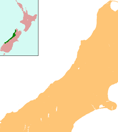
| Description | Locator map for West Coast Region, New Zealand |
| Date | |
| Source | combination of Image:NZ-SI plain map.png and Image:Position of West Coast.png |
| Auteur | Grutness |
| Autorisation (Réutilisation de ce fichier) |
public domain |
Conditions d’utilisation
| Moi, propriétaire des droits d’auteur sur cette œuvre, la place dans le domaine public. Ceci s'applique dans le monde entier. Dans certains pays, ceci peut ne pas être possible ; dans ce cas : J’accorde à toute personne le droit d’utiliser cette œuvre dans n’importe quel but, sans aucune condition, sauf celles requises par la loi. |
Historique du fichier
Cliquer sur une date et heure pour voir le fichier tel qu'il était à ce moment-là.
| Date et heure | Vignette | Dimensions | Utilisateur | Commentaire | |
|---|---|---|---|---|---|
| actuel | 17 juillet 2008 à 15:25 | | 378 × 423 (21 kio) | Grutness | {{Information |Description=== Summary == {{Information |Description=Locator map for West Coast Region, New Zealand |Source=combination of Image:NZ-SI plain map.png and Image:Position of West Coast.png |Date=17 July 2008 |Author=Grutness |Permiss |
Utilisation du fichier
La page suivante utilise ce fichier :
Usage global du fichier
Les autres wikis suivants utilisent ce fichier :
- Utilisation sur ar.wikipedia.org
- Utilisation sur ceb.wikipedia.org
- Utilisation sur en.wikipedia.org
- Kokiri
- Punakaiki
- Franz Josef Glacier
- Crushington, New Zealand
- Lake Christabel
- Brunner, New Zealand
- Hokitika Airport
- Lendenfeld Peak
- Ngahere
- Cronadun
- Te Kuha
- Lake Ianthe
- Pukekura
- Lake Poerua
- Inchbonnie
- Ruatapu, New Zealand
- Lake Mahinapua
- Whataroa River
- Whataroa
- Stillwater, West Coast
- Westport Airport (New Zealand)
- Millerton, New Zealand
- Stockton, New Zealand
- Seddonville
- Summerlea, New Zealand
- Sergeants Hill
- List of schools in the West Coast, New Zealand
- Lake Daniell
- Module:Location map/data/New Zealand West Coast/doc
- Maruia
- Haupiri
- Kokatahi
- Lyell, New Zealand
- Waiuta
- Mount Rolleston
- User:Sladew/Charles Edward Douglas
- Charlie Douglas
- Mount Cook Aerodrome
- Mokihinui
- Module:Location map/data/New Zealand West Coast
- Agassiz Glacier (New Zealand)
- Wallsend, New Zealand
- Dunollie, New Zealand
- Ballroom Overhang
- Pancake Rocks and Blowholes
- Ōtūmahana Estuary
- Gates of Haast
- Utilisation sur fa.wikipedia.org
Voir davantage sur l’utilisation globale de ce fichier.