Fichier:Meemu Atoll.png

Taille de cet aperçu : 714 × 599 pixels. Autres résolutions : 286 × 240 pixels | 572 × 480 pixels | 915 × 768 pixels | 1 220 × 1 024 pixels | 2 440 × 2 048 pixels | 2 610 × 2 191 pixels.
Fichier d’origine (2 610 × 2 191 pixels, taille du fichier : 141 kio, type MIME : image/png)
Ce fichier et sa description proviennent de Wikimedia Commons.
| Description |
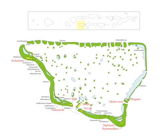
DescriptionMap of w:Meemu_Atoll Map originally vector'ed by Hassan Waheed, Aabaadhuge of Thinadhoo island. Note: This section of map was extracted and its text was romanized by Oblivious. Special assitance by Waddey and Zuru Converted to PNG by helix84
|
| Date | |
| Source | Travail personnel de la personne qui a téléchargé à l'origine le document. |
| Auteur | helix84 |
| Autorisation (Réutilisation de ce fichier) |
GFDL content from English Wikipedia |
Conditions d’utilisation
| Ce fichier est disponible selon les termes de la licence Creative Commons Attribution – Partage dans les Mêmes Conditions 3.0 (non transposée). Sujet aux avertissements. | ||
| ||
| Ce bandeau de licence a été ajouté à ce fichier dans le cadre de la procédure de mise à jour des licences des images sous GFDL. |

|
Vous avez la permission de copier, distribuer et modifier ce document selon les termes de la GNU Free Documentation License version 1.2 ou toute version ultérieure publiée par la Free Software Foundation, sans sections inaltérables, sans texte de première page de couverture et sans texte de dernière page de couverture. Un exemplaire de la licence est inclus dans la section intitulée GNU Free Documentation License. Sujet aux avertissements. |
Historique du fichier
Cliquer sur une date et heure pour voir le fichier tel qu'il était à ce moment-là.
| Date et heure | Vignette | Dimensions | Utilisateur | Commentaire | |
|---|---|---|---|---|---|
| actuel | 19 mars 2014 à 15:49 | | 2 610 × 2 191 (141 kio) | Rotatebot | Bot: Image rotated by 90° |
| 29 octobre 2006 à 01:05 |  | 2 191 × 2 610 (150 kio) | Helix84 | {{Information |Description=== Summary == Map of w:Meemu_Atoll Map originally vector'ed by Hassan Waheed, Aabaadhuge of Thinadhoo island. '''''Note:''' This section of map was extracted and its text was romanized by Oblivious. |
Utilisation du fichier
Aucune page n’utilise ce fichier.
Usage global du fichier
Les autres wikis suivants utilisent ce fichier :
- Utilisation sur ar.wikipedia.org
- Utilisation sur arz.wikipedia.org
- Utilisation sur ceb.wikipedia.org
- Utilisation sur de.wikipedia.org
- Utilisation sur pl.wikipedia.org
- Utilisation sur www.wikidata.org