Fichier:Mapa de la Vega Baja del Segura.svg

Taille de cet aperçu PNG pour ce fichier SVG : 595 × 595 pixels. Autres résolutions : 240 × 240 pixels | 480 × 480 pixels | 768 × 768 pixels | 1 024 × 1 024 pixels | 2 048 × 2 048 pixels.
Fichier d’origine (Fichier SVG, nominalement de 595 × 595 pixels, taille : 504 kio)
Ce fichier et sa description proviennent de Wikimedia Commons.

|
Ce fichier a été remplacé par File:Mapa del Baix Segura.svg. Il est recommandé d’utiliser l’autre fichier. La suppression des fichiers remplacés requiert un accord. Raison: «Better SVG version available, with translatable text tags instead of rendering them as bizarre vectors.»
|

|
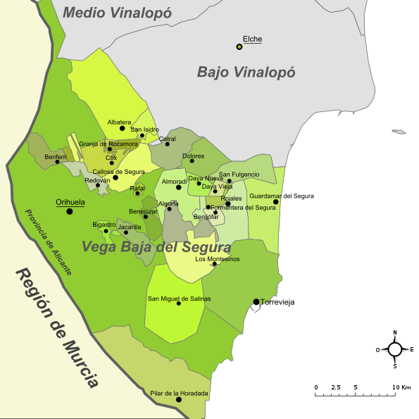
| Description | Mapa de la comarca de la Vega Baja del Segura (provincia de Alicante, España) |
| Date | Original: december 2004. Vectorization: february 2008 |
| Source | Image:Alicante - Mapa municipal.svg, Image:Mapa del Baix Segura.png |
| Auteur | Original: Montxo Vicente i Sempere, uploaded by Martorell, vectorized by Rodriguillo |
| Autorisation (Réutilisation de ce fichier) |
Ce fichier est disponible selon les termes de la licence Creative Commons Attribution – Partage dans les Mêmes Conditions 2.0 Générique
|
| SVG information | Le code de ce fichier SVG n'est pas valide en raison d'une erreur. Cette image vectorielle W3C-invalide a été créée avec Inkscape. |
Historique du fichier
Cliquer sur une date et heure pour voir le fichier tel qu'il était à ce moment-là.
| Date et heure | Vignette | Dimensions | Utilisateur | Commentaire | |
|---|---|---|---|---|---|
| actuel | 1 décembre 2022 à 22:07 | | 595 × 595 (504 kio) | TechnicianGB | Reverted to version as of 21:23, 4 October 2017 (UTC) The new version makes no sense in the naming, which is not official (País Valenciano, Múrcia) |
| 23 août 2022 à 11:59 |  | 595 × 595 (477 kio) | Martorell | Fixing administrative borders between Land of Valencia and Region of Murcia. | |
| 4 octobre 2017 à 23:23 |  | 595 × 595 (504 kio) | PuriGarcía | Reverted to version as of 17:01, 21 March 2008 (UTC) | |
| 4 octobre 2017 à 23:20 |  | 1 280 × 1 280 (19 kio) | PuriGarcía | Nuevos | |
| 21 mars 2008 à 19:01 |  | 595 × 595 (504 kio) | Rodriguillo | {{Information |Description= |Source=self-made |Date= |Author= Rodriguillo |Permission= |other_versions= }} | |
| 22 février 2008 à 19:21 |  | 595 × 595 (512 kio) | Rodriguillo | {{Information |Description= Mapa de la comarca de la '''Marina Alta''' (provincia de Alicante, España) |Source=Image:Mapa de la Marina Alta.png, Image:Alicante - Mapa municipal.svg |Date=Original: december 2004. Vectorization: february 2008 |A |
Utilisation du fichier
Aucune page n’utilise ce fichier.
Usage global du fichier
Les autres wikis suivants utilisent ce fichier :
- Utilisation sur en.wikipedia.org
- Utilisation sur es.wikipedia.org