Fichier:Map of Vigo County Indiana Townships.svg

Taille de cet aperçu PNG pour ce fichier SVG : 512 × 512 pixels. Autres résolutions : 240 × 240 pixels | 480 × 480 pixels | 768 × 768 pixels | 1 024 × 1 024 pixels | 2 048 × 2 048 pixels.
Fichier d’origine (Fichier SVG, nominalement de 512 × 512 pixels, taille : 66 kio)
Ce fichier et sa description proviennent de Wikimedia Commons.
| Description |
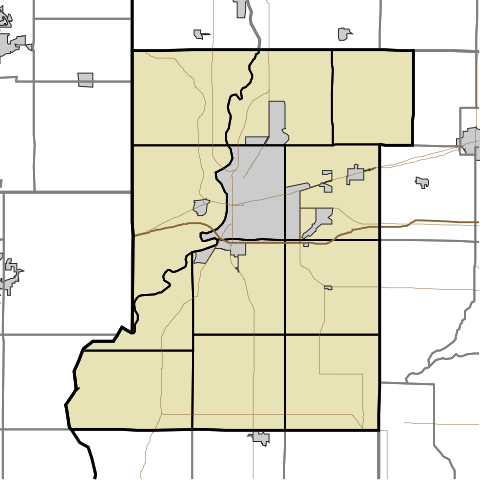
English: This is a map of Vigo County, Indiana, USA divided into townships. |
| Date | (UTC) |
| Source | |
| Auteur |
|
Moi, en tant que détenteur des droits d’auteur sur cette œuvre, je la publie sous la licence suivante :
| Moi, propriétaire des droits d’auteur sur cette œuvre, la place dans le domaine public. Ceci s'applique dans le monde entier. Dans certains pays, ceci peut ne pas être possible ; dans ce cas : J’accorde à toute personne le droit d’utiliser cette œuvre dans n’importe quel but, sans aucune condition, sauf celles requises par la loi. |
Journal des téléversements d’origine
This image is a derivative work of the following images:
- File:Map_highlighting_Prairieton_Township,_Vigo_County,_Indiana.svg licensed with PD-self
- 2007-11-24T19:33:43Z File Upload Bot (Omnedon) 512x512 (37868 Bytes) == Summary == {{Information |Description={{en|This is a map of Vigo County, Indiana, USA which highlights the location of Prairieton Township.}} |Source=My own work, using freely-available TIGER data and custom-written MapSc
Téléversé avec derivativeFX
Historique du fichier
Cliquer sur une date et heure pour voir le fichier tel qu'il était à ce moment-là.
| Date et heure | Vignette | Dimensions | Utilisateur | Commentaire | |
|---|---|---|---|---|---|
| actuel | 14 mai 2010 à 15:50 | | 512 × 512 (66 kio) | Sweet kate | {{Information |Description={{en|This is a map of Vigo County, Indiana, USA divided into townships.}} |Source=*File:Map_highlighting_Prairieton_Township,_Vigo_County,_Indiana.svg |Date=2010-05-14 13:48 (UTC) |Author=*[[:File:Map_highlighting_Prairiet |
Utilisation du fichier
La page suivante utilise ce fichier :
Usage global du fichier
Les autres wikis suivants utilisent ce fichier :
- Utilisation sur ar.wikipedia.org
- Utilisation sur azb.wikipedia.org
- Utilisation sur ceb.wikipedia.org
- Utilisation sur en.wikipedia.org
- Prairieton, Indiana
- Allendale, Indiana
- Libertyville, Indiana
- Sandford, Indiana
- Burnett, Indiana
- Lewis, Indiana
- Pimento, Indiana
- Eugene V. Debs Home
- Prairie Creek, Indiana
- Shirkieville, Indiana
- Emeline Fairbanks Memorial Library
- Terminal Arcade
- Paul Dresser Birthplace
- Vigo, Indiana
- Woodrow Wilson Middle School (Terre Haute, Indiana)
- Church of the Immaculate Conception (Saint Mary-of-the-Woods, Indiana)
- Blessed Sacrament Chapel (Saint Mary-of-the-Woods, Indiana)
- Module:Location map/data/USA Indiana Vigo County/doc
- Vigo County Courthouse
- Allen Chapel African Methodist Episcopal Church (Terre Haute, Indiana)
- Terre Haute Post Office and Federal Building
- Bethany Congregational Church (West Terre Haute, Indiana)
- Hippodrome Theatre (Terre Haute, Indiana)
- Linton Township High School and Community Building
- Ohio Boulevard–Deming Park Historic District
- Sky King Airport
- Condit House
- First National Bank (Terre Haute, Indiana)
- Blackhawk, Indiana
- Whitcomb Heights, Indiana
- Atherton, Indiana
- Barnhart Town, Indiana
- Cherryvale, Indiana
- Coal Bluff, Indiana
- Cobb, Indiana
- Dewey, Indiana
Voir davantage sur l’utilisation globale de ce fichier.