Fichier:Map of Macao boundary.jpg
Taille de cet aperçu : 800 × 568 pixels. Autres résolutions : 320 × 227 pixels | 640 × 455 pixels | 1 024 × 727 pixels | 1 280 × 909 pixels | 1 488 × 1 057 pixels.
Fichier d’origine (1 488 × 1 057 pixels, taille du fichier : 862 kio, type MIME : image/jpeg)
Ce fichier et sa description proviennent de Wikimedia Commons.
Description
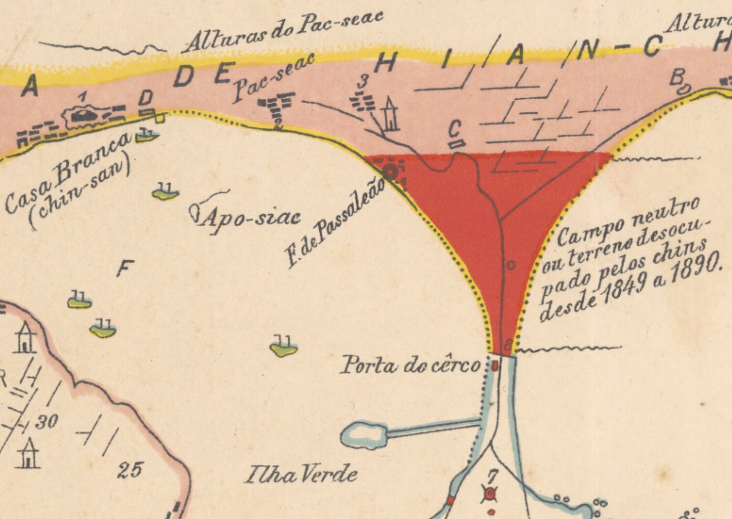
| Description | Section of a map showing the boundary of Macao. |
| Date | |
| Source | http://nla.gov.au/nla.obj-229839109 |
| Auteur | M. Azevedo Coutinho |
Conditions d’utilisation
|
Cette œuvre est également dans le domaine public dans tous les pays pour lesquels le droit d’auteur a une durée de vie de 70 ans ou moins après la mort de l’auteur. Cette œuvre est dans le domaine public aux États-Unis car elle a été publiée avant le 1er janvier 1929. | |
| Ce fichier a été identifié comme étant exempt de restrictions connues liées au droit d’auteur, y compris tous les droits connexes et voisins. | |
Historique du fichier
Cliquer sur une date et heure pour voir le fichier tel qu'il était à ce moment-là.
| Date et heure | Vignette | Dimensions | Utilisateur | Commentaire | |
|---|---|---|---|---|---|
| actuel | 5 août 2018 à 22:19 | | 1 488 × 1 057 (862 kio) | Spellcast | == {{int:filedesc}} == {{Information |Description=Section of a map showing the boundary of Macao. |Date=1901 |Source=http://nla.gov.au/nla.obj-229839109 |Author=M. Azevedo Coutinho }} == {{int:license-header}} == {{PD-old-70-1923}} Category:Old maps of Macau |
Utilisation du fichier
La page suivante utilise ce fichier :
Usage global du fichier
Les autres wikis suivants utilisent ce fichier :
- Utilisation sur en.wikipedia.org