Fichier:Mali.A2001291.1045.250m.jpg

Taille de cet aperçu : 800 × 600 pixels. Autres résolutions : 320 × 240 pixels | 640 × 480 pixels | 1 024 × 768 pixels | 1 280 × 960 pixels | 2 560 × 1 920 pixels | 4 000 × 3 000 pixels.
Fichier d’origine (4 000 × 3 000 pixels, taille du fichier : 1,75 Mio, type MIME : image/jpeg)
Ce fichier et sa description proviennent de Wikimedia Commons.
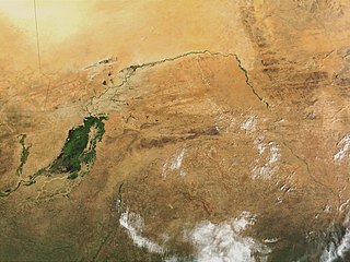
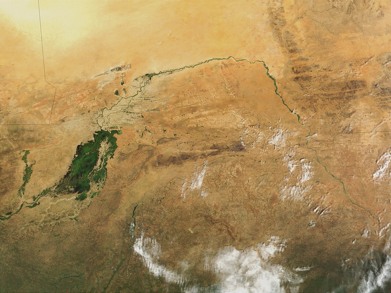
| Description | Niger River in Mali, 2001. Just south of the Sahara Desert in Africa, the Niger River creates a lush area of wetlands and lakes in an otherwise arid environment. In this true-color MODIS image from October 18, 2001, the Niger enters at left as a thin strip of green and flows northeast through Mali. The river then turns south and heads into the country of Niger. (Note, this is at the end of the rainy season, showing the Niger Inland Delta in dark green). | |||||
| Date |
Visualization Date 2001-10-18 |
|||||
| Source | http://veimages.gsfc.nasa.gov/2243/Mali.A2001291.1045.250m.jpg | |||||
| Auteur | Jacques Descloitres, MODIS Land Rapid Response Team, NASA/GSFC | |||||
| Autorisation (Réutilisation de ce fichier) |
PD, US Gov
|

Historique du fichier
Cliquer sur une date et heure pour voir le fichier tel qu'il était à ce moment-là.
| Date et heure | Vignette | Dimensions | Utilisateur | Commentaire | |
|---|---|---|---|---|---|
| actuel | 9 mars 2008 à 00:43 | | 4 000 × 3 000 (1,75 Mio) | T L Miles | {{Information |Description=Niger River in Mali, 2001. Just south of the Sahara Desert in Africa, the Niger River creates a lush area of wetlands and lakes in an otherwise arid environment. In this true-color MODIS image from October 18, 2001, the Niger en |
Utilisation du fichier
La page suivante utilise ce fichier :
Usage global du fichier
Les autres wikis suivants utilisent ce fichier :
- Utilisation sur af.wikipedia.org
- Utilisation sur as.wikipedia.org
- Utilisation sur bg.wikipedia.org
- Utilisation sur ca.wikipedia.org
- Utilisation sur cy.wikipedia.org
- Utilisation sur en.wikipedia.org
- Utilisation sur eo.wikipedia.org
- Utilisation sur ilo.wikipedia.org
- Utilisation sur ja.wikipedia.org
- Utilisation sur la.wikipedia.org
- Utilisation sur no.wikipedia.org
- Utilisation sur oc.wikipedia.org
- Utilisation sur pt.wikipedia.org
- Utilisation sur sr.wikipedia.org
- Utilisation sur sv.wikipedia.org
- Utilisation sur sw.wikipedia.org
- Utilisation sur ta.wikipedia.org
- Utilisation sur uk.wikipedia.org
- Utilisation sur zh.wikipedia.org