Fichier:Locator Austrian Circle.svg

Taille de cet aperçu PNG pour ce fichier SVG : 613 × 600 pixels. Autres résolutions : 245 × 240 pixels | 491 × 480 pixels | 785 × 768 pixels | 1 046 × 1 024 pixels | 2 093 × 2 048 pixels | 1 165 × 1 140 pixels.
Fichier d’origine (Fichier SVG, nominalement de 1 165 × 1 140 pixels, taille : 193 kio)
Ce fichier et sa description proviennent de Wikimedia Commons.
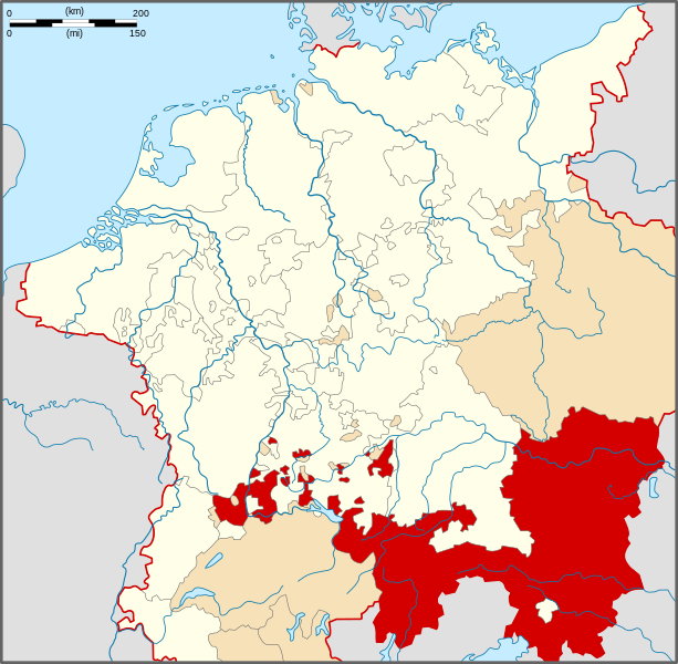
| Description | Locator Map of the Austrian Circle of Holy Roman Empire. |
| Date | |
| Source | PERTHES ATLAS Geschichte |
| Auteur | Sir Iain |
| Autorisation (Réutilisation de ce fichier) |
Attribution ShareAlike 3.0 |
Ce fichier est disponible selon les termes de la licence Creative Commons Attribution – Partage dans les Mêmes Conditions 3.0 (non transposée).
- Vous êtes libre :
- de partager – de copier, distribuer et transmettre cette œuvre
- d’adapter – de modifier cette œuvre
- Sous les conditions suivantes :
- paternité – Vous devez donner les informations appropriées concernant l'auteur, fournir un lien vers la licence et indiquer si des modifications ont été faites. Vous pouvez faire cela par tout moyen raisonnable, mais en aucune façon suggérant que l’auteur vous soutient ou approuve l’utilisation que vous en faites.
- partage à l’identique – Si vous modifiez, transformez, ou vous basez sur cette œuvre, vous devez distribuer votre contribution sous la même licence ou une licence compatible avec celle de l’original.
Historique du fichier
Cliquer sur une date et heure pour voir le fichier tel qu'il était à ce moment-là.
| Date et heure | Vignette | Dimensions | Utilisateur | Commentaire | |
|---|---|---|---|---|---|
| actuel | 28 mars 2010 à 18:18 | | 1 165 × 1 140 (193 kio) | Sir Iain | {{Information |Description=Locator Map of the Austrian Circle of Holy Roman Empire. |Source=PERTHES ATLAS Geschichte |Date=28/03/2010 |Author=Sir Iain |Permission=Attribution ShareAlike 3.0 |other_versions= }} {{cc-by-sa-3.0}} Category:Reichskreise[ |
Utilisation du fichier
La page suivante utilise ce fichier :
Usage global du fichier
Les autres wikis suivants utilisent ce fichier :
- Utilisation sur bg.wikipedia.org
- Utilisation sur cs.wikipedia.org
- Utilisation sur da.wikipedia.org
- Utilisation sur en.wikipedia.org
- Duchy of Carinthia
- History of Tyrol
- Friuli
- Breisgau
- Further Austria
- Bishop of Chur
- Duchy of Carniola
- Austrian Circle
- Prince-Bishopric of Trent
- Tarasp
- Prince-Bishopric of Brixen
- Archduchy of Austria
- County of Tyrol
- County of Gorizia
- Wikipedia:WikiProject Former countries/Holy Roman Empire task force
- Template:Austrian Circle
- March of Carniola
- Duchy of Styria
- An der Etsch
- User:Tisquesusa/sandbox9
- Erblande
- Utilisation sur es.wikipedia.org
- Utilisation sur et.wikipedia.org
- Utilisation sur hr.wikipedia.org
- Utilisation sur id.wikipedia.org
- Utilisation sur ko.wikipedia.org
- Utilisation sur lt.wikipedia.org
- Utilisation sur nl.wikipedia.org
- Utilisation sur pl.wikipedia.org
- Utilisation sur pt.wikipedia.org
- Utilisation sur ru.wikipedia.org
Voir davantage sur l’utilisation globale de ce fichier.