Fichier:Location of Mount St. Helens.png
Fichier d’origine (1 001 × 801 pixels, taille du fichier : 1,8 Mio, type MIME : image/png)
Ce fichier et sa description proviennent de Wikimedia Commons.
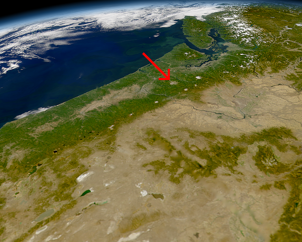
Location of Mount St. Helens, Washington.
NASA Photo, courtesy "NASA Earth From Space" Website; Modified with text by USGS/CVO.[1]
| This image is from the Sea-viewing Wide Field-of-view Sensor (SeaWiFS) Project and more than 5 years old.
Satellite data captured by the SeaWIFS sensor are released into the public domain 5 years after capture. Data less than five years old can be re-used only for educational or scientific purposes; any commercial use of such images must be coordinated with GeoEye. [2] |
| This work has been released into the public domain by its copyright holder, GeoEye. This applies worldwide. Dans certains pays, ceci peut ne pas être possible ; dans ce cas : GeoEye accorde à toute personne le droit d’utiliser cette œuvre dans n’importe quel but, sans aucune condition, sauf celles requises par la loi.
|
- Sensor
- OrbView-2/SeaWiFS
- Datastart
- 2000-09-26
- Visible Earth v1 ID
- 4786
- Visualization Date
- 2000-09-26
http://visibleearth.nasa.gov/view_rec.php?vev1id=4786[lien mort]
relation
Historique du fichier
Cliquer sur une date et heure pour voir le fichier tel qu'il était à ce moment-là.
| Date et heure | Vignette | Dimensions | Utilisateur | Commentaire | |
|---|---|---|---|---|---|
| actuel | 9 août 2005 à 09:27 | | 1 001 × 801 (1,8 Mio) | Complex01 | Location of Mount St. Helens, Washington, September 1994. NASA Photo, courtesy "NASA Earth From Space" Website; Modified with text by USGS/CVO.[http://vulcan.wr.usgs.gov/Volcanoes/MSH/Images/annotated_nasa_images.html] {{PD-USGov-Interior-USGS}} {{PD- |
Utilisation du fichier
Aucune page n’utilise ce fichier.
Usage global du fichier
Les autres wikis suivants utilisent ce fichier :
- Utilisation sur ja.wikipedia.org