Fichier:LocationByzantineEmpire.png
Taille de cet aperçu : 800 × 520 pixels. Autres résolutions : 320 × 208 pixels | 640 × 416 pixels | 1 084 × 705 pixels.
Fichier d’origine (1 084 × 705 pixels, taille du fichier : 29 kio, type MIME : image/png)
Ce fichier et sa description proviennent de Wikimedia Commons.
Description
| Description |
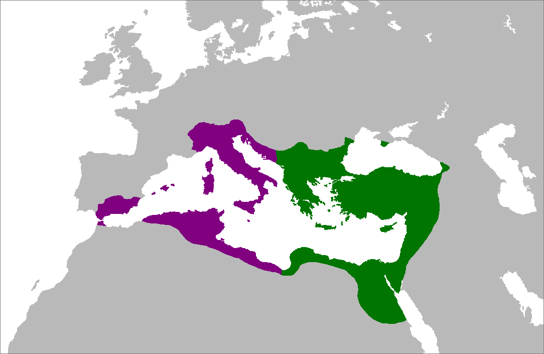
English: Map of the Byzantine Empire at its greatest extent in the 6th century. Territories in purple were reconquered during the reign of Justinian I.
العربية: خريطة الإمبراطورية البيزنطية في أقصى امتداد لها في القرن السادس. تمت السيطرة على الأراضي باللون الأرجواني في عهد جستنيان الأول. |
|||
| Date | ||||
| Source | Travail personnel (Texte original : Self-made from Image:LocationRomanEmpire.png; borders based on a map from http://www.bartleby.com/.) | |||
| Auteur | Zakuragi | |||
| Autres versions |
|


Conditions d’utilisation

|
Vous avez la permission de copier, distribuer et modifier ce document selon les termes de la GNU Free Documentation License version 1.2 ou toute version ultérieure publiée par la Free Software Foundation, sans sections inaltérables, sans texte de première page de couverture et sans texte de dernière page de couverture. Un exemplaire de la licence est inclus dans la section intitulée GNU Free Documentation License. |
| Ce fichier est disponible selon les termes de la licence Creative Commons Attribution – Partage dans les Mêmes Conditions 3.0 (non transposée). | ||
| ||
| Ce bandeau de licence a été ajouté à ce fichier dans le cadre de la procédure de mise à jour des licences des images sous GFDL. |
Historique du fichier
Cliquer sur une date et heure pour voir le fichier tel qu'il était à ce moment-là.
| Date et heure | Vignette | Dimensions | Utilisateur | Commentaire | |
|---|---|---|---|---|---|
| actuel | 5 juillet 2007 à 17:28 | | 1 084 × 705 (29 kio) | Tonym88~commonswiki | minor fix |
| 4 juillet 2007 à 23:58 |  | 1 084 × 705 (29 kio) | Tonym88~commonswiki | {{Information |Description= Map of the Byzantine Empire at its greatest extent in the 6th century. Territories in purple were reconquered during the reign of Justinian I. |Source= Self-made from Image:LocationRomanEmpire.png; borders based on a map f |
Utilisation du fichier
Aucune page n’utilise ce fichier.
Usage global du fichier
Les autres wikis suivants utilisent ce fichier :
- Utilisation sur en.wikipedia.org
- Utilisation sur es.wikipedia.org
- Utilisation sur hy.wikipedia.org
- Utilisation sur ro.wikipedia.org