Fichier:Liliuokalani Protestant Church, Haleiwa, Hawaii (4548646513).jpg

Fichier d’origine (2 816 × 2 112 pixels, taille du fichier : 1,75 Mio, type MIME : image/jpeg)
Ce fichier et sa description proviennent de Wikimedia Commons.
.jpg?uselang=fr)
Description
| Description |
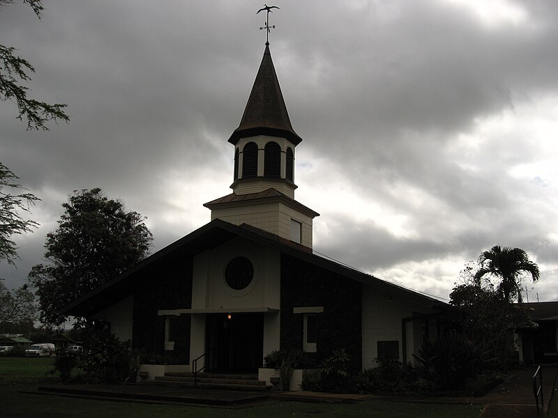
Haleʻiwa is a North Shore community and census-designated place (CDP) in the Waialua District of the island of Oʻahu, City and County of Honolulu. Haleʻiwa is located on Waialua Bay, the mouth of Anahulu Stream (also known as Anahulu River). A small boat harbor is located here, and the shore of the bay is surrounded by Haleʻiwa Beach Park (north side) and Haleʻiwa Aliʻi Beach Park (south side). Further west from the center of town is Kaiaka State Recreation Area on Kiaka Point beside Kaiaka Bay. As of the 2010 census, the CDP had a population of 3,970. It is the largest commercial center on the North Shore of the island. Its old plantation town character is preserved in many of the buildings, making this a popular destination for tourists and residents alike, visiting surfing and diving sites along the north shore. en.wikipedia.org/wiki/Haleiwa,_Hawaii en.wikipedia.org/wiki/Wikipedia:Text_of_Creative_Commons_... |
| Date | |
| Source | Liliuokalani Protestant Church, Hale'iwa, Hawaii |
| Auteur | Ken Lund from Reno, Nevada, USA |
| Lieu de la prise de vue | | Voir cet endroit et d’autres images sur : OpenStreetMap |
|---|
.jpg¶ms=021.591247_N_-158.102735_E_globe:Earth_type:camera_source:Flickr_&language=fr)
Conditions d’utilisation
- Vous êtes libre :
- de partager – de copier, distribuer et transmettre cette œuvre
- d’adapter – de modifier cette œuvre
- Sous les conditions suivantes :
- paternité – Vous devez donner les informations appropriées concernant l'auteur, fournir un lien vers la licence et indiquer si des modifications ont été faites. Vous pouvez faire cela par tout moyen raisonnable, mais en aucune façon suggérant que l’auteur vous soutient ou approuve l’utilisation que vous en faites.
- partage à l’identique – Si vous modifiez, transformez, ou vous basez sur cette œuvre, vous devez distribuer votre contribution sous la même licence ou une licence compatible avec celle de l’original.
| Cette image a été originellement postée sur Flickr par Ken Lund à l'adresse https://flickr.com/photos/75683070@N00/4548646513. Elle a été passée en revue le 5 octobre 2016 par le robot FlickreviewR, qui a confirmé qu'elle se trouvait sous licence cc-by-sa-2.0. |
Historique du fichier
Cliquer sur une date et heure pour voir le fichier tel qu'il était à ce moment-là.
| Date et heure | Vignette | Dimensions | Utilisateur | Commentaire | |
|---|---|---|---|---|---|
| actuel | 5 octobre 2016 à 22:44 | | 2 816 × 2 112 (1,75 Mio) | KAVEBEAR | Transferred from Flickr via Flickr2Commons |
Utilisation du fichier
La page suivante utilise ce fichier :
Usage global du fichier
Les autres wikis suivants utilisent ce fichier :
- Utilisation sur www.wikidata.org
.jpg)