Fichier:Lage des Landkreises Bayreuth in Deutschland.png
Pas de plus haute résolution disponible.
Lage_des_Landkreises_Bayreuth_in_Deutschland.png (197 × 235 pixels, taille du fichier : 3 kio, type MIME : image/png)
Ce fichier et sa description proviennent de Wikimedia Commons.
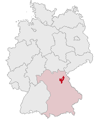
| Description | Landkreis Bayreuth, Bavaria, Germany | ||||||||
| Date | |||||||||
| Source | Travail personnel | ||||||||
| Auteur | own work by Geograv | ||||||||
| Autorisation (Réutilisation de ce fichier) |
|

Historique du fichier
Cliquer sur une date et heure pour voir le fichier tel qu'il était à ce moment-là.
| Date et heure | Vignette | Dimensions | Utilisateur | Commentaire | |
|---|---|---|---|---|---|
| actuel | 29 mai 2008 à 01:14 | | 197 × 235 (3 kio) | Rauenstein | {{Information |Description=Landkreis Bayreuth, Bavaria, Germany |Source=self |Date=2008-05-29 |Author=own work by Geograv |Permission= {{GFDL}} }} Bayreuth [[Ca |
Utilisation du fichier
La page suivante utilise ce fichier :
Usage global du fichier
Les autres wikis suivants utilisent ce fichier :
- Utilisation sur be.wikipedia.org
- Utilisation sur da.wikipedia.org
- Utilisation sur de.wikipedia.org
- Utilisation sur hy.wikipedia.org
- Utilisation sur id.wikipedia.org
- Utilisation sur ja.wikipedia.org
- バイロイト郡
- メールマイゼル
- フィヒテルベルク (オーバーフランケン)
- ヴァルメンシュタイナハ
- ビショフスグリュン
- ゲフレース
- バート・ベルネック・イム・フィヒテルゲビルゲ
- ゴルトクローナハ
- ビントラハ
- ハイナースロイト
- エッカースドルフ
- ミステルバッハ (オーバーフランケン)
- ゲゼース
- フンメルタール
- グラースヒュッテン (オーバーフランケン)
- ミステルガウ
- プランケンフェルス
- ホルフェルト
- アウフゼス
- ヴァイシェンフェルト
- アホルンタール
- ポッテンシュタイン (オーバーフランケン)
- ベッツェンシュタイン
- プレヒ
- ペグニッツ
- シュナーベルヴァイト
- プレビッツ
- ハーク (オーバーフランケン)
- クロイセン
- エムトマンスベルク
- ザイボーテンロイト
- ヴァイデンベルク
- キルヒェンピンガルテン
- シュパイヒャースドルフ
- Utilisation sur ka.wikipedia.org
- Utilisation sur kk.wikipedia.org
- Utilisation sur lmo.wikipedia.org
- Utilisation sur pl.wikipedia.org
- Utilisation sur pt.wikipedia.org