Fichier:Kyoto Myoshinji Temple Aerial View.jpg
Taille de cet aperçu : 533 × 600 pixels. Autres résolutions : 213 × 240 pixels | 427 × 480 pixels | 816 × 918 pixels.
Fichier d’origine (816 × 918 pixels, taille du fichier : 268 kio, type MIME : image/jpeg)
Ce fichier et sa description proviennent de Wikimedia Commons.
Description
| Description |
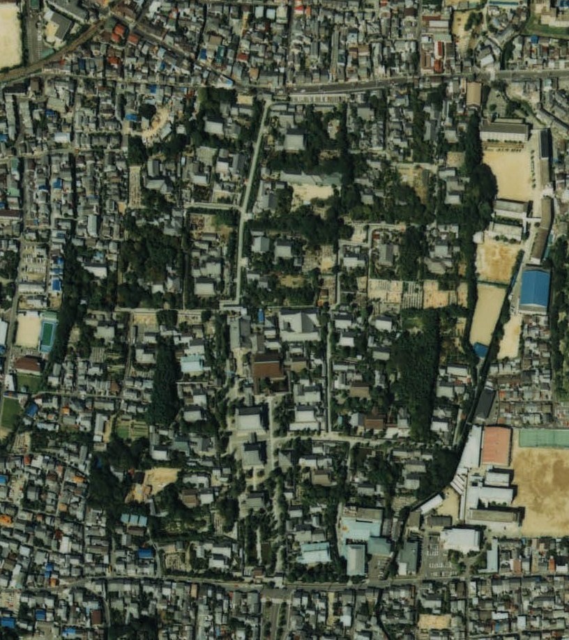
日本語: 京都府京都市右京区にある臨済宗妙心寺派の本山である妙心寺|妙心寺。CKK-87-1 C6-12 |
| Date | |
| Source | 国土情報ウェブマッピングシステム |
| Auteur | 国土交通省 |
Conditions d’utilisation

|
Le détenteur des droits d’auteur de ce fichier, Ministère du Territoire, des Infrastructures, des Transports et du Tourisme, autorise n’importe qui à l’utiliser pour n’importe quelle utilisation, pourvu que le détenteur des droits d’auteur soit correctement attribué. La redistribution, les œuvres dérivées, l’utilisation commerciale et toutes les autres utilisations sont autorisées. |
Attribution:
Copyright © National Land Image Information (Color Aerial Photographs), Ministry of Land, Infrastructure, Transport and Tourism
|
 |
This image is copyrighted by the Ministry of Land, Infrastructure, Transport and Tourism of Japan. For terms of use, see the stipulation to use of National Land Information (in Japanese) and message from MLIT (in Japanese and English). When you display this image on an article, include the following phrase in the description: "Made based on National Land Image Information (Color Aerial Photographs), Ministry of Land, Infrastructure, Transport and Tourism".
|
Historique du fichier
Cliquer sur une date et heure pour voir le fichier tel qu'il était à ce moment-là.
| Date et heure | Vignette | Dimensions | Utilisateur | Commentaire | |
|---|---|---|---|---|---|
| actuel | 15 janvier 2014 à 06:56 | | 816 × 918 (268 kio) | At by At | User created page with UploadWizard |
Utilisation du fichier
La page suivante utilise ce fichier :