Fichier:Jersey War Tunnels - geograph.ci - 350.jpg
Jersey_War_Tunnels_-_geograph.ci_-_350.jpg (640 × 404 pixels, taille du fichier : 294 kio, type MIME : image/jpeg)
Ce fichier et sa description proviennent de Wikimedia Commons.
| Description |
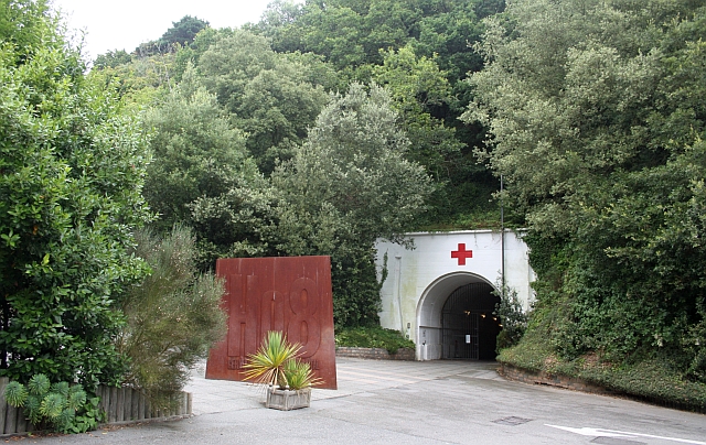
Jersey War Tunnels. The German Underground Hospital, H?angsanlage 8, was built between 1941 and 1944 by using forced labour from countries throughout conquered Europe. |
| Date | |
| Source | From channel-islands.geographs.org; transferred by User:oxyman using geograph_org2commons. |
| Auteur | Bob Embleton |
| Autorisation (Réutilisation de ce fichier) |
Creative Commons Attribution Share-alike license 2.0 |
| Lieu de la prise de vue | | Voir cet endroit et d’autres images sur : OpenStreetMap |
|---|

|
This image was taken from the Geograph Channel Islands collection. See this photograph's page on the Geograph website for the photographer's contact details. The copyright on this image is owned by Bob Embleton and is licensed for reuse under the Creative Commons Attribution-ShareAlike 2.0 license.
|
- Vous êtes libre :
- de partager – de copier, distribuer et transmettre cette œuvre
- d’adapter – de modifier cette œuvre
- Sous les conditions suivantes :
- paternité – Vous devez donner les informations appropriées concernant l'auteur, fournir un lien vers la licence et indiquer si des modifications ont été faites. Vous pouvez faire cela par tout moyen raisonnable, mais en aucune façon suggérant que l’auteur vous soutient ou approuve l’utilisation que vous en faites.
- partage à l’identique – Si vous modifiez, transformez, ou vous basez sur cette œuvre, vous devez distribuer votre contribution sous la même licence ou une licence compatible avec celle de l’original.
Historique du fichier
Cliquer sur une date et heure pour voir le fichier tel qu'il était à ce moment-là.
| Date et heure | Vignette | Dimensions | Utilisateur | Commentaire | |
|---|---|---|---|---|---|
| actuel | 23 mai 2010 à 19:00 | | 640 × 404 (294 kio) | File Upload Bot (Magnus Manske) | {{Information |Description=Jersey War Tunnels. The German Underground Hospital, H?angsanlage 8, was built between 1941 and 1944 by using forced labour from countries throughout conquered Europe. <br /> Its construction involved the removal of 43,900 tonne |
Utilisation du fichier
La page suivante utilise ce fichier :
Usage global du fichier
Les autres wikis suivants utilisent ce fichier :
- Utilisation sur en.wikipedia.org
- Utilisation sur es.wikipedia.org
- Utilisation sur no.wikipedia.org
- Utilisation sur www.wikidata.org