Fichier:JNN-1843-Map.jpg

Taille de cet aperçu : 495 × 600 pixels. Autres résolutions : 198 × 240 pixels | 396 × 480 pixels | 634 × 768 pixels | 845 × 1 024 pixels | 1 690 × 2 048 pixels | 9 484 × 11 491 pixels.
Fichier d’origine (9 484 × 11 491 pixels, taille du fichier : 11,96 Mio, type MIME : image/jpeg)
Ce fichier et sa description proviennent de Wikimedia Commons.
Description
| Description |
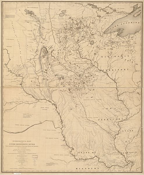
English: Hydrographical basin of the upper Mississippi River from astronomical and barometrical observations, surveys, and information. By J. N. Nicollet, in the years 1836, 37, 38, 39, and 40; assisted in 1838, 39 & 40, by Lieut. J. C. Fremont, of the Corps of Topographical Engineers under the superintendence of the Bureau of the Corps of Topographical Engineers and authorized by the War Department. |
|||||||||||||||||||||||
| Date | ||||||||||||||||||||||||
| Source | U. S. Congress | |||||||||||||||||||||||
| Auteur |
|
|||||||||||||||||||||||

From Library of Congress map collection:http://lcweb2.loc.gov/ammem/gmdhtml/dsxphome.html
Conditions d’utilisation
Ce média est dans le domaine public des États-Unis d’Amérique car son auteur est l’administration américaine comme précisé dans le code fédéral au Titre 17, Chapitre 1, Section 105. Pour en savoir plus : droit d’auteur.
Attention : Ceci ne concerne que le travail du Gouvernement Fédéral et pas celui des États, ou d’une autre subdivision géographique ou politique du pays.
|
 | |
| Ce fichier a été identifié comme étant exempt de restrictions connues liées au droit d’auteur, y compris tous les droits connexes et voisins. | ||
Historique du fichier
Cliquer sur une date et heure pour voir le fichier tel qu'il était à ce moment-là.
| Date et heure | Vignette | Dimensions | Utilisateur | Commentaire | |
|---|---|---|---|---|---|
| actuel | 12 février 2010 à 22:39 | | 9 484 × 11 491 (11,96 Mio) | Gammagrass | {{Information |Description={{en|1=Hydrographical basin of the upper Mississippi River from astronomical and barometrical observations, surveys, and information. By J. N. Nicollet, in the years 1836, 37, 38, 39, and 40; assisted in 1838, 39 & 40, by Lieut. |
Utilisation du fichier
La page suivante utilise ce fichier :
Usage global du fichier
Les autres wikis suivants utilisent ce fichier :
- Utilisation sur ca.wikipedia.org
- Utilisation sur en.wikipedia.org
- Utilisation sur es.wikipedia.org