Fichier:Indonesia West Sumatra location map.svg

Taille de cet aperçu PNG pour ce fichier SVG : 600 × 600 pixels. Autres résolutions : 240 × 240 pixels | 480 × 480 pixels | 768 × 768 pixels | 1 024 × 1 024 pixels | 2 048 × 2 048 pixels | 1 250 × 1 250 pixels.
Fichier d’origine (Fichier SVG, nominalement de 1 250 × 1 250 pixels, taille : 3,51 Mio)
Ce fichier et sa description proviennent de Wikimedia Commons.
Description
| Description |
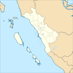
English: Location map of West Sumatra, Indonesia
Geographic Coordinate System WGS 1984 (EPSG: 4326) Equirectangular Projection Geographic limits of the map:
|
| Date | |
| Source | Travail personnel |
| Auteur | Mandamaruta |
Conditions d’utilisation
Moi, en tant que détenteur des droits d’auteur sur cette œuvre, je la publie sous la licence suivante :
Ce fichier est sous la licence Creative Commons Attribution – Partage dans les Mêmes Conditions 4.0 International.
- Vous êtes libre :
- de partager – de copier, distribuer et transmettre cette œuvre
- d’adapter – de modifier cette œuvre
- Sous les conditions suivantes :
- paternité – Vous devez donner les informations appropriées concernant l'auteur, fournir un lien vers la licence et indiquer si des modifications ont été faites. Vous pouvez faire cela par tout moyen raisonnable, mais en aucune façon suggérant que l’auteur vous soutient ou approuve l’utilisation que vous en faites.
- partage à l’identique – Si vous modifiez, transformez, ou vous basez sur cette œuvre, vous devez distribuer votre contribution sous la même licence ou une licence compatible avec celle de l’original.
Historique du fichier
Cliquer sur une date et heure pour voir le fichier tel qu'il était à ce moment-là.
| Date et heure | Vignette | Dimensions | Utilisateur | Commentaire | |
|---|---|---|---|---|---|
| actuel | 21 décembre 2017 à 09:59 | | 1 250 × 1 250 (3,51 Mio) | Mandamaruta | User created page with UploadWizard |
Utilisation du fichier
La page suivante utilise ce fichier :
Usage global du fichier
Les autres wikis suivants utilisent ce fichier :
- Utilisation sur ban.wikipedia.org
- Utilisation sur en.wikipedia.org
- Utilisation sur he.wikipedia.org
- Utilisation sur id.wikipedia.org
- Daftar kabupaten dan kota di Sumatera Barat
- Rumah Rasuna Said
- Daftar kecamatan dan kelurahan di Sumatera Barat
- Prasasti Pariangan
- Rumah Gadang Baanjuang Tanjung Raya
- Candi Padangroco
- Templat:Location map Sumatera Barat
- Medan Bapaneh Gunung
- Gedung Controlleur Buo
- Daftar kabupaten dan kota di Sumatera Barat berdasarkan waktu pembentukan
- Utilisation sur os.wikipedia.org
- Utilisation sur www.wikidata.org