Fichier:India Chhattisgarh relief map.svg

Taille de cet aperçu PNG pour ce fichier SVG : 479 × 600 pixels. Autres résolutions : 191 × 240 pixels | 383 × 480 pixels | 613 × 768 pixels | 817 × 1 024 pixels | 1 635 × 2 048 pixels | 1 152 × 1 443 pixels.
Fichier d’origine (Fichier SVG, nominalement de 1 152 × 1 443 pixels, taille : 1,73 Mio)
Ce fichier et sa description proviennent de Wikimedia Commons.
Description
| Description |
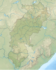
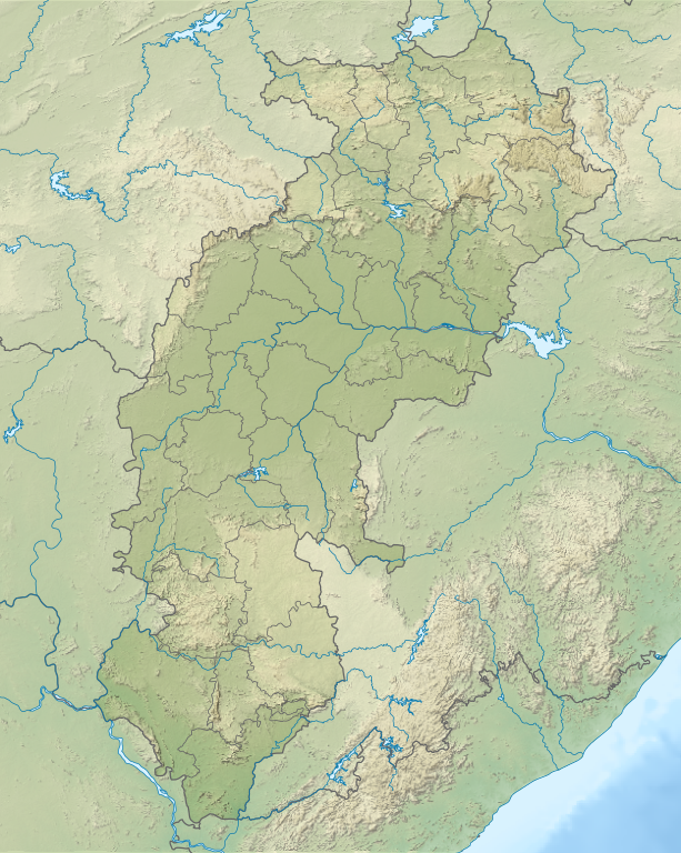
English: Relief map of Chhattisgarh. Relief data from STRM 3 |
| Date | |
| Source | Derivative of File:India Chhattisgarh location map.svg |
| Auteur | Own work based on User:Milenioscuro |
Conditions d’utilisation
Ce fichier est sous la licence Creative Commons Attribution – Partage dans les Mêmes Conditions 4.0 International.
- Vous êtes libre :
- de partager – de copier, distribuer et transmettre cette œuvre
- d’adapter – de modifier cette œuvre
- Sous les conditions suivantes :
- paternité – Vous devez donner les informations appropriées concernant l'auteur, fournir un lien vers la licence et indiquer si des modifications ont été faites. Vous pouvez faire cela par tout moyen raisonnable, mais en aucune façon suggérant que l’auteur vous soutient ou approuve l’utilisation que vous en faites.
- partage à l’identique – Si vous modifiez, transformez, ou vous basez sur cette œuvre, vous devez distribuer votre contribution sous la même licence ou une licence compatible avec celle de l’original.
Historique du fichier
Cliquer sur une date et heure pour voir le fichier tel qu'il était à ce moment-là.
| Date et heure | Vignette | Dimensions | Utilisateur | Commentaire | |
|---|---|---|---|---|---|
| actuel | 19 juillet 2022 à 06:52 | | 1 152 × 1 443 (1,73 Mio) | C1MM | c Sarangarh dist |
| 23 avril 2022 à 07:45 |  | 1 152 × 1 443 (1,72 Mio) | C1MM | New districts | |
| 12 mai 2021 à 07:12 |  | 934 × 1 286 (1,4 Mio) | C1MM | Added better relief and boundaries | |
| 15 janvier 2021 à 21:25 |  | 1 613 × 2 221 (1,56 Mio) | C1MM | Increased colour contrast | |
| 17 décembre 2020 à 01:53 |  | 1 613 × 2 221 (2,11 Mio) | C1MM | Changed colours of the relief map | |
| 24 octobre 2020 à 07:10 |  | 1 613 × 2 221 (2,04 Mio) | C1MM | Fixed colors for relief and added bathymetry | |
| 21 avril 2020 à 19:43 |  | 1 531 × 2 221 (2,34 Mio) | C1MM | Added rivers | |
| 20 avril 2020 à 22:37 |  | 1 531 × 2 221 (2,3 Mio) | C1MM | Uploaded a work by Based on Milenoscuro from Own work based on File:India Chhattisgarh location map with UploadWizard |
Utilisation du fichier
Les 32 pages suivantes utilisent ce fichier :
- Ambikapur
- Baikunthpur (Koriya)
- Balod
- Baloda Bazar
- Balrampur (Chhattisgarh)
- Bemetara
- Bhilai
- Bijapur (Chhattisgarh)
- Bilaspur (Chhattisgarh)
- Centrale de Korba
- Centrale de Sipat
- Dantewada
- Dhamtari
- Durg
- Jagdalpur
- Jashpur Nagar
- Kanker
- Kawardha
- Kondagaon
- Korba (Inde)
- Mahasamund
- Mine de Dipka
- Mine de Gevra
- Mine de Kusmunda
- Mungeli
- Naila Janjgir
- Raipur
- Rajnandgaon
- Sukma
- Surajpur
- Modèle:Géolocalisation/Chhattisgarh
- Modèle:Géolocdual/Chhattisgarh
Usage global du fichier
Les autres wikis suivants utilisent ce fichier :
- Utilisation sur bn.wikipedia.org
- Utilisation sur de.wikipedia.org
- Utilisation sur en.wikipedia.org
- Kanger Valley National Park
- Chitrakote Falls
- Achanakmar Wildlife Sanctuary
- Murrum Silli Dam
- Kherkatta Dam
- Bailadila Range
- Mahan Small Hydel Project
- Sirpur Group of Monuments
- Tamda Ghumar
- Mandwa Waterfalls
- Mendri Ghumar
- Module:Location map/data/India Chhattisgarh
- Module:Location map/data/India Chattisgarh
- Module:Location map/data/India Chhattisgarh/doc
- Chhindari Dam
- Utilisation sur es.wikipedia.org
- Utilisation sur hi.wikipedia.org
- Utilisation sur ja.wikipedia.org
- Utilisation sur lv.wikipedia.org
- Utilisation sur or.wikipedia.org
- Utilisation sur pa.wikipedia.org
- Utilisation sur si.wikipedia.org
- Utilisation sur ta.wikipedia.org