Fichier:ISS006-E-36005 - View of Cuba - Trinidad (Sancti Spiritus province).jpg

Fichier d’origine (3 032 × 2 064 pixels, taille du fichier : 861 kio, type MIME : image/jpeg)
Ce fichier et sa description proviennent de Wikimedia Commons.
.jpg?uselang=fr)
Description
| Description |
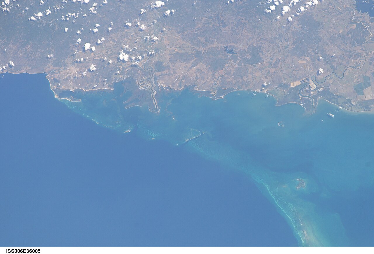
English: View of Cuba taken during ISS Expedition 6. South coast of Cuba, Sancti Spíritus province. Trinidad on the left and, on the right, the Zaza river separating the municipalities of Trinidad and La Sierpe.
On the left, the first two small nicks in the coast are rio Cabagán (limit between Cumanayagua west and Trinidad east) and rio Guanayara.
|
| Date | |
| Source | JSC Gateway to Astronaut Photography of Earth |
| Auteur | Earth Science and Remote Sensing Unit, centre spatial Lyndon B. Johnson |
| Mission | ISS006 |
| Roll | E |
| Frame | 36005 |
| Geographic area | Cuba |
| Features | TRINIDAD,SAN PEDRO, REEFS |
| Cloud percentage | 10% |
| Altitude | 212 nautical miles (393 km) |
| Look angle | 30 |
| Look direction | E |
| Sun Azimuth | 139° |
| Sun Elevation | 56° |
| Camera | Kodak DCS760c Electronic Still Camera |
| Focal length | 180 mm |
| Lieu de la prise de vue | | Voir cet endroit et d’autres images sur : OpenStreetMap |
|---|
.jpg¶ms=021.400000_N_-081.500000_E_globe:Earth_type:camera__&language=fr)
| Position de l'objet | | Voir cet endroit et d’autres images sur : OpenStreetMap |
|---|
.jpg¶ms=021.500000_N_-079.500000_E_globe:Earth_class:object_type:object__&language=fr)
Cette image ou vidéo a été cataloguée par le Johnson Space Center de la National Aeronautics and Space Administration (NASA) des États-Unis sous Photo ID : ISS006-E-36005.Ce bandeau n’indique rien sur le statut de l’œuvre au regard du droit d'auteur. Un bandeau de droit d’auteur est requis. Voir Commons:À propos des licences pour plus d’informations. Autres langues :
|
Conditions d’utilisation
| Ce fichier provient de la NASA. Sauf exception, les documents créés par la NASA ne sont pas soumis à copyright. Pour plus d'informations, voir la politique de copyright de la NASA. | ||
 |
Attention :
|
Historique du fichier
Cliquer sur une date et heure pour voir le fichier tel qu'il était à ce moment-là.
| Date et heure | Vignette | Dimensions | Utilisateur | Commentaire | |
|---|---|---|---|---|---|
| actuel | 9 août 2022 à 23:33 | | 3 032 × 2 064 (861 kio) | AskeBot |
Utilisation du fichier
La page suivante utilise ce fichier :
.jpg)