Fichier:Grangemouthmap1945.jpg

Taille de cet aperçu : 730 × 599 pixels. Autres résolutions : 292 × 240 pixels | 585 × 480 pixels | 936 × 768 pixels | 1 247 × 1 024 pixels | 2 495 × 2 048 pixels | 3 525 × 2 894 pixels.
Fichier d’origine (3 525 × 2 894 pixels, taille du fichier : 4,92 Mio, type MIME : image/jpeg)
Ce fichier et sa description proviennent de Wikimedia Commons.
This work is an Ordnance Survey map over 50 years old, which is covered by Crown Copyright which in this case expires 50 years after publication. Ordnance Survey does however ask that they be credited and that the date of publication be given.
Any ancillary rights gained through the creation of the electronic version are granted as freely usable under any circumstances.
|
Cette œuvre d'art créée par le Gouvernement du Royaume-Uni se trouve dans le domaine public.
Ceci est la conséquence de l'un des points suivants :
Plus d'informations (en anglais). Voir aussi Droit d'auteur et œuvres d'art sous Crown copyright (en anglais).
|
 |
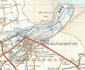
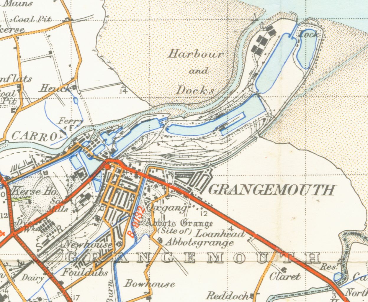
| Description | map of Grangemouth 1 inch to the mile scale scanned at 900 DPI |
| Date | |
| Source | OS map stirling and Dunfermline sheet 67 1945 |
| Auteur | OS |
Historique du fichier
Cliquer sur une date et heure pour voir le fichier tel qu'il était à ce moment-là.
| Date et heure | Vignette | Dimensions | Utilisateur | Commentaire | |
|---|---|---|---|---|---|
| actuel | 31 mars 2007 à 03:18 | | 3 525 × 2 894 (4,92 Mio) | Geni | {{oldOS}} {{Information |Description=map of Grangemouth 1 inch to the mile scale scanned at 900 DPI |Source=OS map stirling and Dunfermline sheet 67 1945 |Date=1945 |Author=OS |Permission=none needed |other_versions= }} Category:Maps of Fife |
Utilisation du fichier
La page suivante utilise ce fichier :
Usage global du fichier
Les autres wikis suivants utilisent ce fichier :
- Utilisation sur azb.wikipedia.org
- Utilisation sur de.wikipedia.org
- Utilisation sur en.wikipedia.org
- Utilisation sur no.wikipedia.org