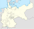
Fichier:German Empire blank map.svg

Taille de cet aperçu PNG pour ce fichier SVG : 754 × 599 pixels. Autres résolutions : 302 × 240 pixels | 604 × 480 pixels | 966 × 768 pixels | 1 280 × 1 018 pixels | 2 560 × 2 035 pixels | 1 425 × 1 133 pixels.
Fichier d’origine (Fichier SVG, nominalement de 1 425 × 1 133 pixels, taille : 1 014 kio)
Historique du fichier
Cliquer sur une date et heure pour voir le fichier tel qu'il était à ce moment-là.
| Date et heure | Vignette | Dimensions | Utilisateur | Commentaire | |
|---|---|---|---|---|---|
| actuel | 1 juin 2024 à 23:26 |  | 1 425 × 1 133 (1 014 kio) | Alphathon | Corrected Austro-Hungrian–Russian border |
| 2 août 2021 à 04:06 |  | 1 425 × 1 133 (1 011 kio) | Milenioscuro | new scheme | |
| 3 novembre 2015 à 00:14 |  | 976 × 818 (756 kio) | Alphathon | Removed Dutch Zuiderzee Polders, which did not yet exist at the time of the German Empire | |
| 2 novembre 2015 à 17:33 |  | 976 × 818 (759 kio) | Alphathon | Corrected Schleswig-Holstein border (was part of Prussia but was shown as being separate) | |
| 9 septembre 2014 à 23:19 |  | 976 × 818 (767 kio) | Milenioscuro | User created page with UploadWizard |
Utilisation du fichier
Aucune page n’utilise ce fichier.
Usage global du fichier
Les autres wikis suivants utilisent ce fichier :
- Utilisation sur de.wikipedia.org
- Utilisation sur sl.wikipedia.org