Fichier:GOES 16 Advanced Baseline Imager multi-channel of North America 20170115 1807.png
Taille de cet aperçu : 800 × 507 pixels. Autres résolutions : 320 × 203 pixels | 640 × 406 pixels | 1 024 × 649 pixels | 1 280 × 812 pixels | 2 406 × 1 526 pixels.
Fichier d’origine (2 406 × 1 526 pixels, taille du fichier : 4,3 Mio, type MIME : image/png)
Ce fichier et sa description proviennent de Wikimedia Commons.
Description
| Description |
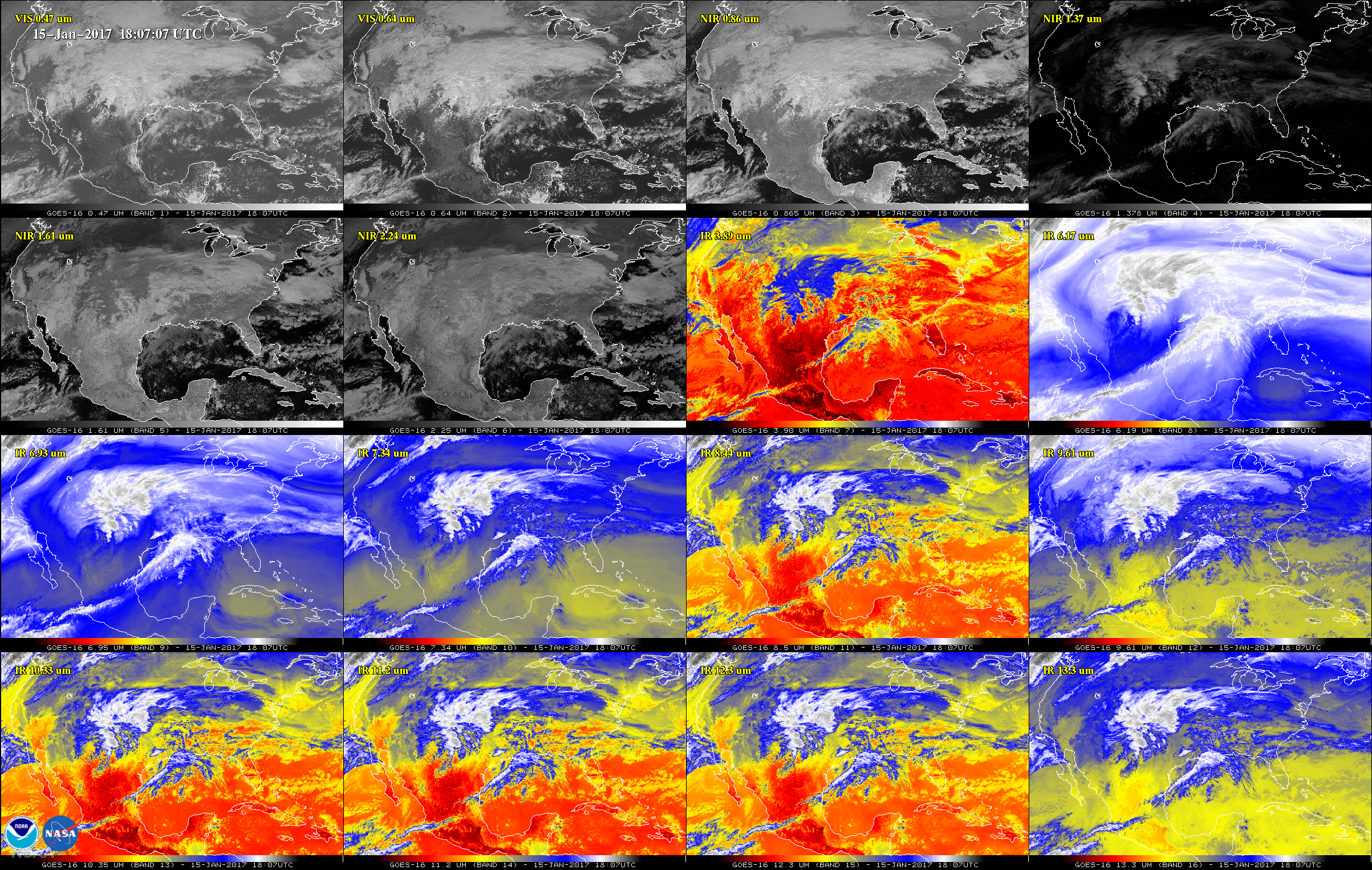
English: This 16-panel image shows the continental United States in the two visible, four near-infrared and 10 infrared channels on the Advanced Baseline Imager (ABI) of GOES 16. These channels help forecasters distinguish between differences in the atmosphere like clouds, water vapor, smoke, ice and volcanic ash. |
| Date | Prise le 15 janvier 2017, 18:07 |
| Source | https://www.nasa.gov/feature/goddard/2017/goes-16-sends-first-images-to-earth (image link) |
| Auteur | NOAA/NASA |
Conditions d’utilisation
Cette image est dans le domaine public car son contenu provient de la
National Oceanic and Atmospheric Administration , réalisé par un employé dans le cadre de ses activités professionnelles.
|
Historique du fichier
Cliquer sur une date et heure pour voir le fichier tel qu'il était à ce moment-là.
| Date et heure | Vignette | Dimensions | Utilisateur | Commentaire | |
|---|---|---|---|---|---|
| actuel | 24 janvier 2017 à 03:14 | | 2 406 × 1 526 (4,3 Mio) | Huntster | {{Information |Description={{en|1=This 16-panel image shows the continental United States in the two visible, four near-infrared and 10 infrared channels on the Advanced Baseline Imager (ABI) of GOES 16. These channels help forecasters distinguish betw... |
Utilisation du fichier
La page suivante utilise ce fichier :
Usage global du fichier
Les autres wikis suivants utilisent ce fichier :
- Utilisation sur en.wikipedia.org