Fichier:Former Broxburn Shale Oil Works - geograph.org.uk - 1018508.jpg
Pas de plus haute résolution disponible.
Former_Broxburn_Shale_Oil_Works_-_geograph.org.uk_-_1018508.jpg (640 × 480 pixels, taille du fichier : 86 kio, type MIME : image/jpeg)
Ce fichier et sa description proviennent de Wikimedia Commons.
Description
| Description |
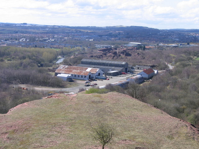
English: Former Broxburn Shale Oil Works Taken from the top of the tip comprising the waste rock from which the oil has been extracted, the surviving buildings of the former shale oil works, now known as Albyn Industrial Estate, are in the middle of the picture, with the villages of Broxburn and, to the right, Uphall beyond and some of the buildings of Livingston New Town visible on the far skyline. |
| Date | |
| Source | From geograph.org.uk |
| Auteur | A-M-Jervis |
| Attribution (imposé par la licence) | A-M-Jervis / Former Broxburn Shale Oil Works / |
| Lieu de la prise de vue | | Voir cet endroit et d’autres images sur : OpenStreetMap |
|---|
_heading:225.00&language=fr)
| Position de l'objet | | Voir cet endroit et d’autres images sur : OpenStreetMap |
|---|
_heading:225.00&language=fr)
Conditions d’utilisation

|
Cette image provient de la collection du projet Geograph British Isles. Pour obtenir les coordonnées du photographe, veuillez consulter cette page de description de l'image sur le site du projet. Les droits d'auteurs sur cette image sont détenus par A-M-Jervis ; l'image est placée sous une licence Creative Commons avec mention de paternité et partage à l'identique (CC-By-SA) en version 2.0.
|
Ce fichier est disponible selon les termes de la licence Creative Commons Attribution – Partage dans les Mêmes Conditions 2.0 Générique
Attribution: A-M-Jervis
- Vous êtes libre :
- de partager – de copier, distribuer et transmettre cette œuvre
- d’adapter – de modifier cette œuvre
- Sous les conditions suivantes :
- paternité – Vous devez donner les informations appropriées concernant l'auteur, fournir un lien vers la licence et indiquer si des modifications ont été faites. Vous pouvez faire cela par tout moyen raisonnable, mais en aucune façon suggérant que l’auteur vous soutient ou approuve l’utilisation que vous en faites.
- partage à l’identique – Si vous modifiez, transformez, ou vous basez sur cette œuvre, vous devez distribuer votre contribution sous la même licence ou une licence compatible avec celle de l’original.
Historique du fichier
Cliquer sur une date et heure pour voir le fichier tel qu'il était à ce moment-là.
| Date et heure | Vignette | Dimensions | Utilisateur | Commentaire | |
|---|---|---|---|---|---|
| actuel | 23 février 2011 à 12:48 | | 640 × 480 (86 kio) | GeographBot | == {{int:filedesc}} == {{Information |description={{en|1=Former Broxburn Shale Oil Works Taken from the top of the tip comprising the waste rock from which the oil has been extracted, the surviving buildings of the former shale oil works, now known as Alb |
Utilisation du fichier
La page suivante utilise ce fichier :
Usage global du fichier
Les autres wikis suivants utilisent ce fichier :
- Utilisation sur azb.wikipedia.org
- Utilisation sur en.wikipedia.org
- Utilisation sur nl.wikipedia.org
- Utilisation sur sco.wikipedia.org