Fichier:Fonuafoon tonga 1928.jpg

Taille de cet aperçu : 577 × 600 pixels. Autres résolutions : 231 × 240 pixels | 633 × 658 pixels.
Fichier d’origine (633 × 658 pixels, taille du fichier : 98 kio, type MIME : image/jpeg)
Ce fichier et sa description proviennent de Wikimedia Commons.
Description
| Description |
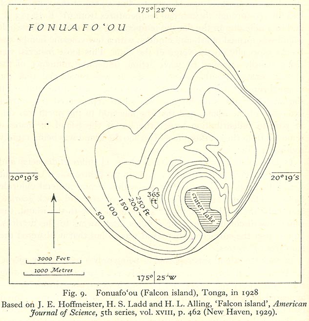
English: 1928 map of Fonuafoʻou Island, a periodically existing island in the west of the Haʻapai Group, Tonga, Pacific Ocean |
| Date | |
| Source | http://www.lib.utexas.edu/maps/historical/pacific_islands_1943_1945/fonuafoon_tonga_1928.jpg |
| Auteur | Auteur inconnu |
| Autorisation (Réutilisation de ce fichier) |
"Most of the maps scanned by the University of Texas Libraries and served from this web site are in the public domain. No permissions are needed to copy them. You may download them and use them as you wish. A few maps are copyrighted, and are clearly marked as such." |
Conditions d’utilisation
| This work has been released into the public domain by its copyright holder, University of Texas Libraries. This applies worldwide. Dans certains pays, ceci peut ne pas être possible ; dans ce cas : University of Texas Libraries accorde à toute personne le droit d’utiliser cette œuvre dans n’importe quel but, sans aucune condition, sauf celles requises par la loi.
|
Historique du fichier
Cliquer sur une date et heure pour voir le fichier tel qu'il était à ce moment-là.
| Date et heure | Vignette | Dimensions | Utilisateur | Commentaire | |
|---|---|---|---|---|---|
| actuel | 25 juin 2010 à 08:50 | | 633 × 658 (98 kio) | Ratzer | {{Information |Description={{en|1=x}} |Source=x |Author=x |Date=x |Permission= |other_versions= }} |
Utilisation du fichier
La page suivante utilise ce fichier :
Usage global du fichier
Les autres wikis suivants utilisent ce fichier :
- Utilisation sur de.wikipedia.org
- Utilisation sur to.wikipedia.org
- Utilisation sur uk.wikipedia.org