Fichier:EasternVirginia1775.jpg

Fichier d’origine (3 360 × 2 660 pixels, taille du fichier : 2,84 Mio, type MIME : image/jpeg)
Ce fichier et sa description proviennent de Wikimedia Commons.
Description
| Description |
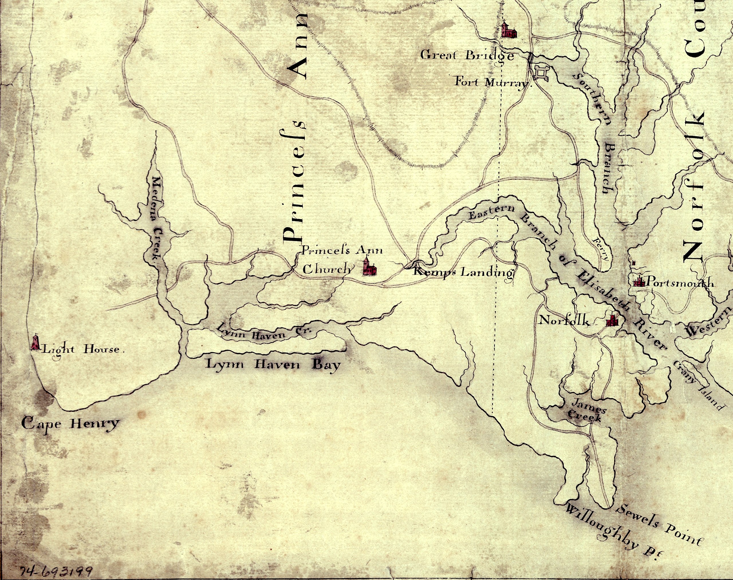
English: Detail of a 1780s manuscript map depicting the eastern coastal areas of Virginia, including portions of "Princess Anne" and Norfolk counties. The map is oriented with North to the bottom and South to the top. Part of the mouth of Chesapeake Bay is visible at the bottom of the map. The map depicts the sites of several military actions fought on land in the early days of the American Revolutionary War, including w:en:Battle of Kemp's Landing, w:en:Battle of Great Bridge, and the w:en:Burning of Norfolk, and the site of two sea battles of the war, the First and Second Battles of the Capes, the latter also known as w:en:Battle of the Chesapeake. |
||
| Date | vers 1785 (Following a logistical and political delay of about 17 years, construction of the Cape Henry Lighthouse w:en:Cape Henry Light, depicted on the map, began about 1791 and was completed in 1792), LC claims "1779?;" Worldcat [1] claims "1785?". [See also "Early Map of First Colony’s Easternmost Landscape, Landmarks and Landowners"[2].]Hogident (d) 08:12, 26 January 2015 (UTC) | ||
| Source |
|
||
| Auteur | Auteur inconnu | ||
| Autorisation (Réutilisation de ce fichier) |
[NP: Request a change in file name, since it contains a contradiction in the date(s) of the map.] |

Conditions d’utilisation
|
Cette œuvre est également dans le domaine public dans tous les pays pour lesquels le droit d’auteur a une durée de vie de 70 ans ou moins après la mort de l’auteur.
| |
| Ce fichier a été identifié comme étant exempt de restrictions connues liées au droit d’auteur, y compris tous les droits connexes et voisins. | |
Historique du fichier
Cliquer sur une date et heure pour voir le fichier tel qu'il était à ce moment-là.
| Date et heure | Vignette | Dimensions | Utilisateur | Commentaire | |
|---|---|---|---|---|---|
| actuel | 5 août 2010 à 17:58 | | 3 360 × 2 660 (2,84 Mio) | Magicpiano | {{Information |Description={{en|Detail of a 1770s manuscript map depicting the eastern coastal areas of Virginia, including portions of Princess Ann and Norfolk Counties. The map is oriented with North to the bottom and South to the top. Part of the |
Utilisation du fichier
Les 2 pages suivantes utilisent ce fichier :
Usage global du fichier
Les autres wikis suivants utilisent ce fichier :
- Utilisation sur ca.wikipedia.org
- Utilisation sur en.wikipedia.org
- Utilisation sur fi.wikipedia.org
- Utilisation sur ja.wikipedia.org
- Utilisation sur pt.wikipedia.org
- Utilisation sur ru.wikipedia.org
- Utilisation sur www.wikidata.org