Fichier:East Langton, Leicestershire - geograph.org.uk - 587829.jpg
Pas de plus haute résolution disponible.
East_Langton,_Leicestershire_-_geograph.org.uk_-_587829.jpg (640 × 513 pixels, taille du fichier : 130 kio, type MIME : image/jpeg)
Ce fichier et sa description proviennent de Wikimedia Commons.
Description
| Description |
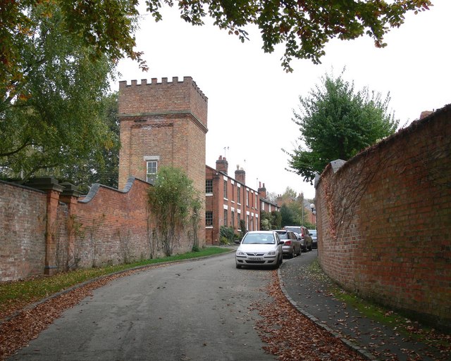
English: East Langton, Leicestershire The large castellated water tower belongs to East Langton Grange. Text from :
J M Lee and R A McKinley, 'Church Langton', in A History of the County of Leicestershire: Volume 5, Gartree Hundred (London, 1964), pp. 193-213. British History Online http://www.british-history.ac.uk/vch/leics/vol5/pp193-213 [accessed 15 February 2020].
|
| Date | |
| Source | From geograph.org.uk |
| Auteur | Mat Fascione |
| Attribution (imposé par la licence) | Mat Fascione / East Langton, Leicestershire / |
| Lieu de la prise de vue | | Voir cet endroit et d’autres images sur : OpenStreetMap |
|---|
_heading:22.00&language=fr)
| Position de l'objet | | Voir cet endroit et d’autres images sur : OpenStreetMap |
|---|
_heading:22.00&language=fr)
Conditions d’utilisation

|
Cette image provient de la collection du projet Geograph British Isles. Pour obtenir les coordonnées du photographe, veuillez consulter cette page de description de l'image sur le site du projet. Les droits d'auteurs sur cette image sont détenus par Mat Fascione ; l'image est placée sous une licence Creative Commons avec mention de paternité et partage à l'identique (CC-By-SA) en version 2.0.
|
Ce fichier est disponible selon les termes de la licence Creative Commons Attribution – Partage dans les Mêmes Conditions 2.0 Générique
Attribution: Mat Fascione
- Vous êtes libre :
- de partager – de copier, distribuer et transmettre cette œuvre
- d’adapter – de modifier cette œuvre
- Sous les conditions suivantes :
- paternité – Vous devez donner les informations appropriées concernant l'auteur, fournir un lien vers la licence et indiquer si des modifications ont été faites. Vous pouvez faire cela par tout moyen raisonnable, mais en aucune façon suggérant que l’auteur vous soutient ou approuve l’utilisation que vous en faites.
- partage à l’identique – Si vous modifiez, transformez, ou vous basez sur cette œuvre, vous devez distribuer votre contribution sous la même licence ou une licence compatible avec celle de l’original.
- Retirez les catégories redondantes et essayer d'associer cette image aux catégories les plus spécifiques possible
- Retirez ce bandeau
- Les catégories de localisation géographique se basent sur les informations de cet outil de recherche du nom par géolocalisation et par cet outil d'OpenStreetMap, combinés à une base de données. Vous pouvez aussi consulter cet outil fourni par mysociety.
- La catégorie de sujet issue site Geograph.org.uk était Village (vous pouvez rechercher des images similaires sur le site Geograph.org.uk)
Historique du fichier
Cliquer sur une date et heure pour voir le fichier tel qu'il était à ce moment-là.
| Date et heure | Vignette | Dimensions | Utilisateur | Commentaire | |
|---|---|---|---|---|---|
| actuel | 6 février 2011 à 15:38 | | 640 × 513 (130 kio) | GeographBot | == {{int:filedesc}} == {{Information |description={{en|1=East Langton, Leicestershire The large castellated water tower belongs to East Langton Grange.}} |date=2007-10-14 |source=From [http://www.geograph.org.uk/photo/587829 geograph.org.uk] |author=[http |
Utilisation du fichier
La page suivante utilise ce fichier :
Usage global du fichier
Les autres wikis suivants utilisent ce fichier :
- Utilisation sur en.wikipedia.org
- Utilisation sur fa.wikipedia.org