Fichier:Dease and Simpson - Arctic expedition 1837.png

Taille de cet aperçu : 800 × 472 pixels. Autres résolutions : 320 × 189 pixels | 640 × 378 pixels | 1 024 × 605 pixels | 1 280 × 756 pixels | 2 395 × 1 414 pixels.
Fichier d’origine (2 395 × 1 414 pixels, taille du fichier : 288 kio, type MIME : image/png)
Ce fichier et sa description proviennent de Wikimedia Commons.
Description
| Description |
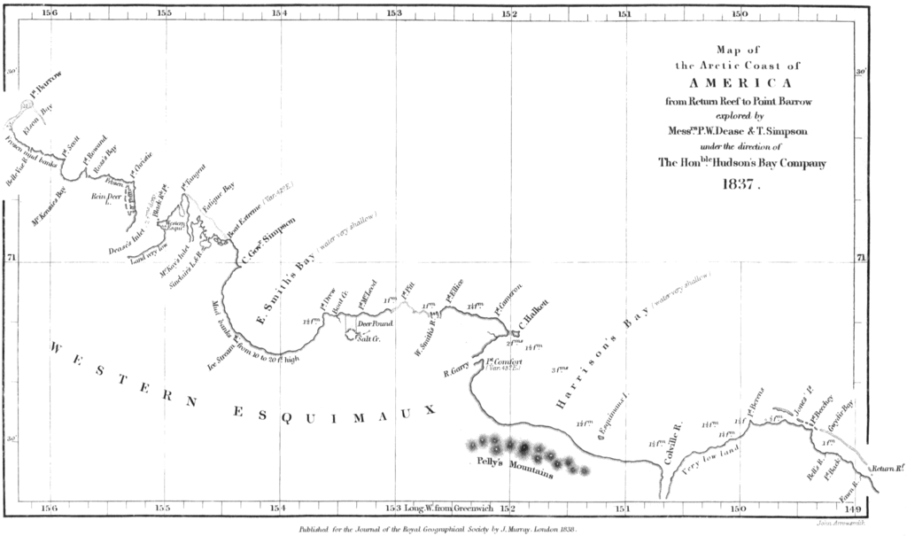
English: Map of the northern coast of Alaska, from Point Burrow on the western edge to Return Reef (just east of the Colville River) on the eastern. Mapped by Peter W. Dease and Thomas Simpson in 1837, during their Arctic expedition. |
|||||||||||||||||
| Date | ||||||||||||||||||
| Source | Peter W. Dease and Thomas Simpson, "An Account of the Recent Arctic Discoveries by Messrs. Dease and T. Simpson", Journal of the Royal Geographical Society of London 8: 213-225, 1838. | |||||||||||||||||
| Auteur |
|
|||||||||||||||||

Conditions d’utilisation
|
L’auteur est mort en 1873 ; cette œuvre est donc également dans le domaine public dans tous les pays pour lesquels le droit d’auteur a une durée de vie de 100 ans ou moins après la mort de l’auteur. Cette œuvre est dans le domaine public aux États-Unis car elle a été publiée avant le 1er janvier 1929. | |
| Ce fichier a été identifié comme étant exempt de restrictions connues liées au droit d’auteur, y compris tous les droits connexes et voisins. | |
Historique du fichier
Cliquer sur une date et heure pour voir le fichier tel qu'il était à ce moment-là.
| Date et heure | Vignette | Dimensions | Utilisateur | Commentaire | |
|---|---|---|---|---|---|
| actuel | 18 janvier 2009 à 12:29 | | 2 395 × 1 414 (288 kio) | Delirium | {{Information |Description={{en|1=Map of the northern coast of Alaska, from Point Burrow on the western edge to Return Reef (just east of the Colville River) on the eastern. Mapped by Peter W. Dease and Thomas Simpson in 1837, during their Arctic expediti |
Utilisation du fichier
La page suivante utilise ce fichier :
Usage global du fichier
Les autres wikis suivants utilisent ce fichier :
- Utilisation sur arz.wikipedia.org
- Utilisation sur bg.wikipedia.org
- Utilisation sur ca.wikipedia.org
- Utilisation sur ceb.wikipedia.org
- Utilisation sur es.wikipedia.org
- Utilisation sur eu.wikipedia.org
- Utilisation sur www.wikidata.org