Fichier:Danesmoor (site of the Battle of Edgcote) - geograph.org.uk - 815349.jpg
Pas de plus haute résolution disponible.
Danesmoor_(site_of_the_Battle_of_Edgcote)_-_geograph.org.uk_-_815349.jpg (640 × 480 pixels, taille du fichier : 71 kio, type MIME : image/jpeg)
Ce fichier et sa description proviennent de Wikimedia Commons.
_-_geograph.org.uk_-_815349.jpg?uselang=fr)
Description
| Description |
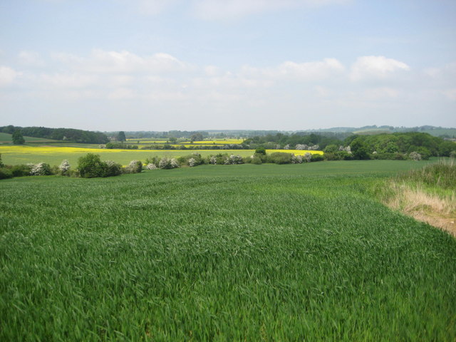
English: Danesmoor (site of the Battle of Edgcote) The Battle of Edgcote during the Wars of the Roses took place in this now tranquil vale close to the river Cherwel. The Earl of Pembroke and his mainly Welsh troops were travelling north to support Edward IV at Nottingham and came upon the rebel army led by Robin of Redesdale who were moving south to join forces with Warwick (the Kingmaker). The battle on the 26th July 1469 was a black day for the Welsh, Pembroke was captured and executed and 168 Welsh noblemen were killed along with many hundreds of common soldiers. |
| Date | |
| Source | From geograph.org.uk |
| Auteur | David M Jones |
| Attribution (imposé par la licence) | David M Jones / Danesmoor (site of the Battle of Edgcote) / |
| Lieu de la prise de vue | | Voir cet endroit et d’autres images sur : OpenStreetMap |
|---|
_-_geograph.org.uk_-_815349.jpg¶ms=052.114770_N_-001.238900_E_globe:Earth_type:camera_source:geograph-osgb36(SP52214654)_heading:0.00&language=fr)
| Position de l'objet | | Voir cet endroit et d’autres images sur : OpenStreetMap |
|---|
_-_geograph.org.uk_-_815349.jpg¶ms=052.118540_N_-001.238100_E_globe:Earth_class:object_type:object_source:geograph-osgb36(SP52264696)_heading:0.00&language=fr)
Conditions d’utilisation

|
Cette image provient de la collection du projet Geograph British Isles. Pour obtenir les coordonnées du photographe, veuillez consulter cette page de description de l'image sur le site du projet. Les droits d'auteurs sur cette image sont détenus par David M Jones ; l'image est placée sous une licence Creative Commons avec mention de paternité et partage à l'identique (CC-By-SA) en version 2.0.
|
Ce fichier est disponible selon les termes de la licence Creative Commons Attribution – Partage dans les Mêmes Conditions 2.0 Générique
Attribution: David M Jones
- Vous êtes libre :
- de partager – de copier, distribuer et transmettre cette œuvre
- d’adapter – de modifier cette œuvre
- Sous les conditions suivantes :
- paternité – Vous devez donner les informations appropriées concernant l'auteur, fournir un lien vers la licence et indiquer si des modifications ont été faites. Vous pouvez faire cela par tout moyen raisonnable, mais en aucune façon suggérant que l’auteur vous soutient ou approuve l’utilisation que vous en faites.
- partage à l’identique – Si vous modifiez, transformez, ou vous basez sur cette œuvre, vous devez distribuer votre contribution sous la même licence ou une licence compatible avec celle de l’original.
Historique du fichier
Cliquer sur une date et heure pour voir le fichier tel qu'il était à ce moment-là.
| Date et heure | Vignette | Dimensions | Utilisateur | Commentaire | |
|---|---|---|---|---|---|
| actuel | 20 février 2011 à 13:45 | | 640 × 480 (71 kio) | GeographBot | == {{int:filedesc}} == {{Information |description={{en|1=Danesmoor (site of the Battle of Edgcote) The Battle of Edgcote during the Wars of the Roses took place in this now tranquil vale close to the river Cherwel. The Earl of Pembroke and his mainly Wels |
Utilisation du fichier
La page suivante utilise ce fichier :
Usage global du fichier
Les autres wikis suivants utilisent ce fichier :
- Utilisation sur cs.wikipedia.org
- Utilisation sur da.wikipedia.org
- Utilisation sur en.wikipedia.org
- Utilisation sur fa.wikipedia.org
- Utilisation sur it.wikipedia.org
- Utilisation sur ru.wikipedia.org
_-_geograph.org.uk_-_815349.jpg)