Fichier:Conneaut Ohio aerial view.jpg

Taille de cet aperçu : 800 × 561 pixels. Autres résolutions : 320 × 224 pixels | 640 × 449 pixels | 1 024 × 718 pixels | 1 280 × 898 pixels | 1 500 × 1 052 pixels.
Fichier d’origine (1 500 × 1 052 pixels, taille du fichier : 697 kio, type MIME : image/jpeg)
Ce fichier et sa description proviennent de Wikimedia Commons.
Description
| Description |
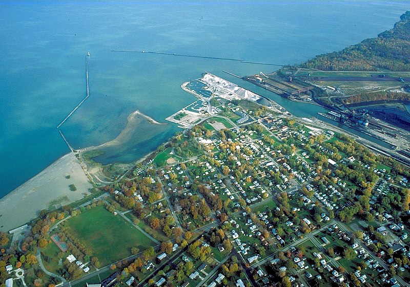
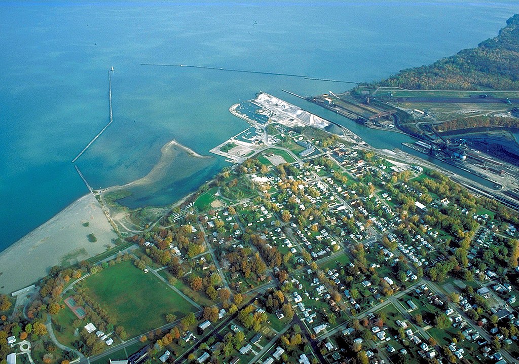
English: Aerial view of the port and harbor at Conneaut, Ohio, USA, on Lake Erie. View is to the northeast over the lake. |
| Date | Prise le 28 octobre 1992 |
| Source |
U.S. Army Corps of Engineers Digital Visual Library Image page Image description page Digital Visual Library home page |
| Auteur | Ken Winters, U.S. Army Corps of Engineers |
| Lieu | Conneaut, Ohio, USA |
| Lieu de la prise de vue | | Voir cet endroit et d’autres images sur : OpenStreetMap |
|---|
Conditions d’utilisation
This image or file is a work of a U.S. Army Corps of Engineers soldier or employee, taken or made as part of that person's official duties. As a work of the U.S. federal government, the image is in the public domain.
|
Historique du fichier
Cliquer sur une date et heure pour voir le fichier tel qu'il était à ce moment-là.
| Date et heure | Vignette | Dimensions | Utilisateur | Commentaire | |
|---|---|---|---|---|---|
| actuel | 31 mars 2007 à 07:54 | | 1 500 × 1 052 (697 kio) | DanMS | {{Information | Description = {{en|Aerial view of the port and harbor at Conneaut, Ohio, USA, on Lake Erie. View is to the northeast over the lake.}} | Source = U.S. Army Corps of Engineers Digital Visual Library<br />[http://images.usace.army. |
Utilisation du fichier
Les 2 pages suivantes utilisent ce fichier :
Usage global du fichier
Les autres wikis suivants utilisent ce fichier :
- Utilisation sur ar.wikipedia.org
- Utilisation sur arz.wikipedia.org
- Utilisation sur azb.wikipedia.org
- Utilisation sur ca.wikipedia.org
- Utilisation sur ceb.wikipedia.org
- Utilisation sur ce.wikipedia.org
- Utilisation sur cy.wikipedia.org
- Utilisation sur dag.wikipedia.org
- Utilisation sur de.wikipedia.org
- Utilisation sur en.wikipedia.org
- Utilisation sur en.wikivoyage.org
- Utilisation sur es.wikipedia.org
- Utilisation sur eu.wikipedia.org
- Utilisation sur fa.wikipedia.org
- Utilisation sur ht.wikipedia.org
- Utilisation sur hu.wikipedia.org
- Utilisation sur it.wikipedia.org
- Utilisation sur ky.wikipedia.org
- Utilisation sur lld.wikipedia.org
- Utilisation sur pl.wikipedia.org
- Utilisation sur pt.wikipedia.org
- Utilisation sur sh.wikipedia.org
- Utilisation sur simple.wikipedia.org
- Utilisation sur sr.wikipedia.org
- Utilisation sur szl.wikipedia.org
- Utilisation sur tr.wikipedia.org
- Utilisation sur tt.wikipedia.org
- Utilisation sur uk.wikipedia.org
- Utilisation sur uz.wikipedia.org
- Utilisation sur vi.wikipedia.org
- Utilisation sur vo.wikipedia.org
- Utilisation sur www.wikidata.org
- Utilisation sur zh-min-nan.wikipedia.org