Fichier:Celles Hainaut Belgium Map.png
Pas de plus haute résolution disponible.
Celles_Hainaut_Belgium_Map.png (355 × 278 pixels, taille du fichier : 8 kio, type MIME : image/png)
Ce fichier et sa description proviennent de Wikimedia Commons.

|
Une version vectorielle de cette image existe, dans le format « SVG ». Si elle n’est pas inférieure, elle devrait être utilisée à la place de la présente version pour des affichages en plus grandes dimensions ou nécessitant une meilleure résolution.
File:Celles Hainaut Belgium Map.png → File:Celles Hainaut Belgium Map.svg
Pour plus d’informations sur les images vectorielles, consultez la page de transition de Commons vers le format SVG. Voir aussi les informations à propos de la manière dont le logiciel MediaWiki gère les images au format SVG. |
 |
| Description |
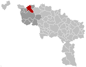
English: Map, municipality belgium Celles
Français : Carte indiquant la localisation de la commune de Celles dans la Province de Hainaut. |
| Source | Travail personnel |
| Auteur | LennartBolks |
| Autorisation (Réutilisation de ce fichier) |
PD |
| Cette œuvre a été placée dans le domaine public par son auteur, LennartBolks. Ceci s’applique dans le monde entier. Dans certains pays, ceci peut ne pas être possible ; dans ce cas : |
Historique du fichier
Cliquer sur une date et heure pour voir le fichier tel qu'il était à ce moment-là.
| Date et heure | Vignette | Dimensions | Utilisateur | Commentaire | |
|---|---|---|---|---|---|
| actuel | 5 mars 2007 à 11:51 | | 355 × 278 (8 kio) | Siebrand | Updated map by Westermarck |
| 28 mars 2005 à 23:34 |  | 355 × 278 (6 kio) | Nicnac25~commonswiki | Map, municipality belgium Celles {{PD}} FR; Carte indiquant la localisation de la commune de Celles dans la Province de Hainaut. EN; Map from w:nl:Gebruiker:LennartBolks/kaartenhoekje in Public Domain by the Author choice. [[Category:Maps of provinc |
Utilisation du fichier
Aucune page n’utilise ce fichier.