Fichier:Carte du Conseil de l'Europe.png
Taille de cet aperçu : 784 × 600 pixels. Autres résolutions : 314 × 240 pixels | 628 × 480 pixels | 1 004 × 768 pixels | 1 200 × 918 pixels.
Fichier d’origine (1 200 × 918 pixels, taille du fichier : 284 kio, type MIME : image/png)
Ce fichier et sa description proviennent de Wikimedia Commons.

|
Une version vectorielle de cette image existe, dans le format « SVG ». Si elle n’est pas inférieure, elle devrait être utilisée à la place de la présente version pour des affichages en plus grandes dimensions ou nécessitant une meilleure résolution.
File:Carte du Conseil de l'Europe.png → File:Map of Council of Europe member states by founding and later members.svg
Pour plus d’informations sur les images vectorielles, consultez la page de transition de Commons vers le format SVG. Voir aussi les informations à propos de la manière dont le logiciel MediaWiki gère les images au format SVG. |
 |
Description
| Description | |
| Date | |
| Source | Own work by uploader, based on Image:Euro 2008.png |
| Auteur | JLogan |
Conditions d’utilisation
Moi, en tant que détenteur des droits d’auteur sur cette œuvre, je la publie sous les licences suivantes :
Ce fichier est disponible selon les termes de la licence Creative Commons Attribution – Partage dans les Mêmes Conditions 3.0 (non transposée).
- Vous êtes libre :
- de partager – de copier, distribuer et transmettre cette œuvre
- d’adapter – de modifier cette œuvre
- Sous les conditions suivantes :
- paternité – Vous devez donner les informations appropriées concernant l'auteur, fournir un lien vers la licence et indiquer si des modifications ont été faites. Vous pouvez faire cela par tout moyen raisonnable, mais en aucune façon suggérant que l’auteur vous soutient ou approuve l’utilisation que vous en faites.
- partage à l’identique – Si vous modifiez, transformez, ou vous basez sur cette œuvre, vous devez distribuer votre contribution sous la même licence ou une licence compatible avec celle de l’original.

|
Vous avez la permission de copier, distribuer et modifier ce document selon les termes de la GNU Free Documentation License version 1.2 ou toute version ultérieure publiée par la Free Software Foundation, sans sections inaltérables, sans texte de première page de couverture et sans texte de dernière page de couverture. Un exemplaire de la licence est inclus dans la section intitulée GNU Free Documentation License. |
Vous pouvez choisir l’une de ces licences.
Historique du fichier
Cliquer sur une date et heure pour voir le fichier tel qu'il était à ce moment-là.
| Date et heure | Vignette | Dimensions | Utilisateur | Commentaire | |
|---|---|---|---|---|---|
| actuel | 11 mars 2022 à 19:50 | | 1 200 × 918 (284 kio) | Sbb1413 | Update. |
| 1 octobre 2020 à 15:19 |  | 1 200 × 1 000 (38 kio) | Super Dromaeosaurus | Added Isle of Man, Guernsey and Jersey | |
| 6 janvier 2015 à 06:49 |  | 1 200 × 1 000 (52 kio) | Jurryaany | Fixed German sovereignty over Borkum. | |
| 14 novembre 2013 à 05:52 |  | 1 200 × 1 000 (48 kio) | Che829 | Reverted to version as of 21:36, 19 August 2008 - Nonfactual unsupported claim as per official documents published by CoE (Founders are only the 10 original signatories of w:Treaty of London (1949) on 5 May 1949 at St. James's Palace in London http... | |
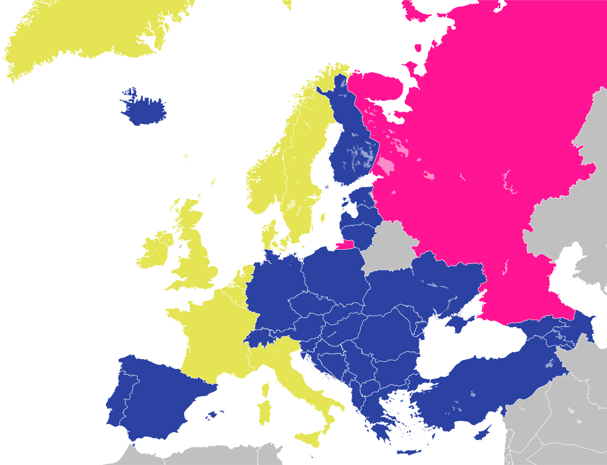
| 13 février 2009 à 23:27 |  | 1 200 × 1 000 (43 kio) | Emturan | Greece and Turkey are striped to show their founder member status while they joined to Council of Europe later. | |
| 19 août 2008 à 23:36 |  | 1 200 × 1 000 (48 kio) | JLogan | {{Information |Description={{en|1=Map of the Council of Europe.<br />{{legend|#e4e454|Founder}}{{legend|#2b42a3|Later member}}}} {{fr|1=Carte du Conseil de l'Europe.<br />{{legend|#e4e454|Fondateurs}}{{legend|#2b42a3|Autres}}}} | |
Utilisation du fichier
La page suivante utilise ce fichier :
Usage global du fichier
Les autres wikis suivants utilisent ce fichier :
- Utilisation sur en.wikipedia.org
- Utilisation sur hy.wikipedia.org
- Utilisation sur ja.wikipedia.org
- Utilisation sur ru.wikipedia.org