Fichier:Carte du Congo Belge.png

Fichier d’origine (7 372 × 10 032 pixels, taille du fichier : 99,43 Mio, type MIME : image/png)
Ce fichier et sa description proviennent de Wikimedia Commons.
Description
| Description |
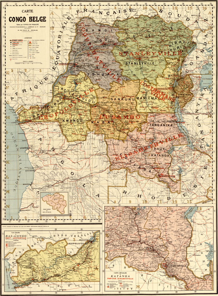
English: This map is claimed to be from 1896. But that is probably not true. In 1896 neither the “Congo Belge” nor “Tanganyika” existed. Tanganyika was founded in 1919 (treaty of Versailles), thus it seems not to be created before 1919. |
||||
| Date | 1896? But probably after 1919 | ||||
| Source | Library of Congress See also: Library of Congress-Carte du Congo Belge. | ||||
| Auteur | Bureau de la publicité, J. Lebègue & Cie, Bruxelles | ||||
| Autorisation (Réutilisation de ce fichier) |
|
||||
| Autres versions |
|
||||

Historique du fichier
Cliquer sur une date et heure pour voir le fichier tel qu'il était à ce moment-là.
| Date et heure | Vignette | Dimensions | Utilisateur | Commentaire | |
|---|---|---|---|---|---|
| actuel | 15 juillet 2013 à 18:28 | | 7 372 × 10 032 (99,43 Mio) | Chricho | {{Information |Description ={{en|1=This map is claimed to be from 1896. But that is probably not true. In 1896 neither the “Congo Belge” nor “Tanganyika” existed. Tanganyika was founded in 1919 (treaty of Versailles), thus it seems not to be... |
Utilisation du fichier
Les 4 pages suivantes utilisent ce fichier :