Fichier:Cape hatteras 1989.jpg
Taille de cet aperçu : 603 × 600 pixels. Autres résolutions : 241 × 240 pixels | 483 × 480 pixels | 772 × 768 pixels | 1 030 × 1 024 pixels | 2 060 × 2 048 pixels | 5 300 × 5 270 pixels.
Fichier d’origine (5 300 × 5 270 pixels, taille du fichier : 11,19 Mio, type MIME : image/jpeg)
Ce fichier et sa description proviennent de Wikimedia Commons.
Description
| Description |
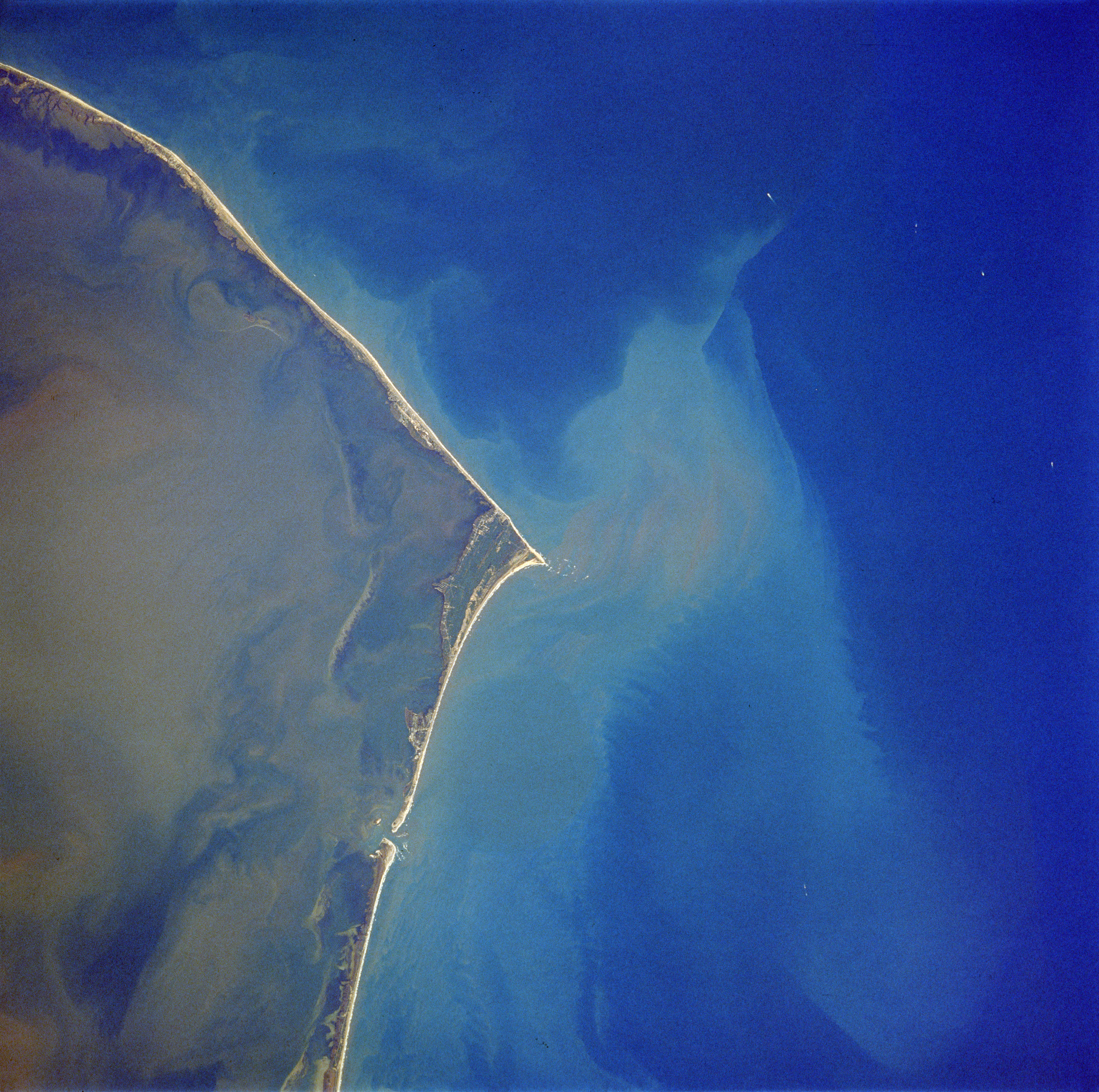
English: Cape Hatteras, North Carolina, USA - October 1989
|
| Date | Prise le 21 octobre 1989, 17:38:53 UTC |
| Source | http://eol.jsc.nasa.gov/sseop/EFS/photoinfo.pl?PHOTO=STS034-83-69 |
| Auteur | NASA |
Cette image ou vidéo a été cataloguée par le Johnson Space Center de la National Aeronautics and Space Administration (NASA) des États-Unis sous Photo ID : STS034-83-69.Ce bandeau n’indique rien sur le statut de l’œuvre au regard du droit d'auteur. Un bandeau de droit d’auteur est requis. Voir Commons:À propos des licences pour plus d’informations. Autres langues :
|
Conditions d’utilisation
"The Gateway to Astronaut Photography of Earth". Image provenant du Laboratoire d'Analyse et d'Imagerie des Sciences, Centre Spatial Johnson de la NASA.
Source de la photo : STS034-83-69.
|
Journal des téléversements d’origine
La page de description originale était ici. Tous les noms d'utilisateur qui suivent se rapportent à en.wikipedia.
- 2006-05-20 01:37 Patricklyons 626×639× (152696 bytes) {{PD-USGov-NASA}}
- 2005-06-08 15:28 Darwinek 626×639× (80977 bytes)
Historique du fichier
Cliquer sur une date et heure pour voir le fichier tel qu'il était à ce moment-là.
| Date et heure | Vignette | Dimensions | Utilisateur | Commentaire | |
|---|---|---|---|---|---|
| actuel | 14 mai 2019 à 22:18 | | 5 300 × 5 270 (11,19 Mio) | Ras67 | high resolution |
| 27 août 2012 à 20:58 |  | 626 × 639 (149 kio) | OgreBot | (BOT): Uploading old version of file from en.wikipedia; originally uploaded on 2006-05-20 01:37:56 by Patricklyons | |
| 27 août 2012 à 20:58 |  | 626 × 639 (79 kio) | OgreBot | (BOT): Uploading old version of file from en.wikipedia; originally uploaded on 2005-06-08 15:28:12 by Darwinek | |
| 26 août 2012 à 11:42 |  | 626 × 639 (149 kio) | Bulwersator | + | |
| 22 mars 2007 à 22:26 |  | 587 × 599 (43 kio) | Pierre cb | {{Information |Description=Cape Hatteras, North Carolina, USA - October 1989 |Source= [http://eol.jsc.nasa.gov/sseop/EFS/photoinfo.pl?PHOTO=STS034-83-69 NASA] |Date=October 1989 |Author= ~~~~ |Permission= {{PD-USGov-NASA}} |other_versions=None }} [[Catego |
Utilisation du fichier
Les 3 pages suivantes utilisent ce fichier :
Usage global du fichier
Les autres wikis suivants utilisent ce fichier :
- Utilisation sur ar.wikipedia.org
- Utilisation sur ca.wikipedia.org
- Utilisation sur ceb.wikipedia.org
- Utilisation sur cs.wikipedia.org
- Utilisation sur de.wikipedia.org
- Utilisation sur en.wikipedia.org
- Utilisation sur eo.wikipedia.org
- Utilisation sur es.wikipedia.org
- Utilisation sur it.wikipedia.org
- Utilisation sur ja.wikipedia.org
- Utilisation sur no.wikipedia.org
- Utilisation sur pl.wikipedia.org
- Utilisation sur pt.wikipedia.org
- Utilisation sur ru.wikipedia.org
- Utilisation sur sr.wikipedia.org
- Utilisation sur uk.wikipedia.org
- Utilisation sur uz.wikipedia.org
- Utilisation sur www.wikidata.org