Fichier:Battle of Surabaya (1677) 4.VEL 1279.jpg

Taille de cet aperçu : 800 × 571 pixels. Autres résolutions : 320 × 228 pixels | 640 × 457 pixels | 1 024 × 731 pixels | 1 280 × 914 pixels | 2 560 × 1 827 pixels | 8 889 × 6 344 pixels.
Fichier d’origine (8 889 × 6 344 pixels, taille du fichier : 9,54 Mio, type MIME : image/jpeg)
Ce fichier et sa description proviennent de Wikimedia Commons.
_4.VEL_1279.jpg?uselang=fr)
Description
| Description |
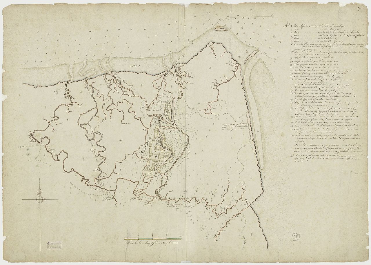
English: Map of Battle of Surabaya (1677) when the battle is in progress.
Positions of Trunajaya and Dutch forces, including artillery batteries, fortifications and structures are depicted At this point the Dutch has taken Ampel but Trunajaya still control the city center. |
| Date | |
| Source |
|
| Auteur | Dutch East India Company, published by the Dutch National Archives |
Surabaya
Conditions d’utilisation
National Archive policy released maps and document under "Public domain or CC0" [1] copie d'archive sur Wayback Machine. The map itself was from 1677, so in any likelihood the author died centuries ago placing the work under public domain.
| Ce fichier est disponible selon les termes de la licence Creative Commons CC0 Don universel au domaine public. | |
| La personne qui a associé une œuvre avec cet acte l’a placée dans le domaine public en renonçant mondialement à tous ses droits sur cette œuvre en vertu des lois relatives au droit d’auteur, ainsi qu’à tous les droits juridiques connexes et voisins qu’elle possédait sur l’œuvre, sans autre limite que celles imposées par la loi. Vous pouvez copier, modifier, distribuer et utiliser cette œuvre, y compris à des fins commerciales, sans qu’il soit nécessaire d’en demander la permission.
|
Historique du fichier
Cliquer sur une date et heure pour voir le fichier tel qu'il était à ce moment-là.
| Date et heure | Vignette | Dimensions | Utilisateur | Commentaire | |
|---|---|---|---|---|---|
| actuel | 8 avril 2017 à 09:49 | | 8 889 × 6 344 (9,54 Mio) | HaEr48 | User created page with UploadWizard |
Utilisation du fichier
La page suivante utilise ce fichier :
Usage global du fichier
Les autres wikis suivants utilisent ce fichier :
- Utilisation sur en.wikipedia.org
- Utilisation sur id.wikipedia.org
_4.VEL_1279.jpg)