Fichier:Barentsz Full Map.jpg

Taille de cet aperçu : 800 × 594 pixels. Autres résolutions : 320 × 237 pixels | 640 × 475 pixels | 1 000 × 742 pixels.
Fichier d’origine (1 000 × 742 pixels, taille du fichier : 258 kio, type MIME : image/jpeg)
Ce fichier et sa description proviennent de Wikimedia Commons.
Description
| Description |
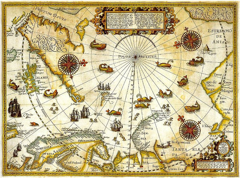
1598 map of the hree Arctic voyages (1594–1596) by Willem Barentsz. Delineatio cartae trium navigantium per Bataves, ad Septentrionalem plagam, Norvegiae, Moscoviae et novae Semblae Autore Wilhelmo Bernardo [1] [2] |
| Date | |
| Source | immediate source unknown, uploaded 2007 |
| Auteur | Willem Barentsz (Wilhelmus Bernardus) |
| Autorisation (Réutilisation de ce fichier) |
Public domain (over 70 years since creator's death) |
| Autres versions |
|

.jpg)
_door_Willem_Barendsz_(titel_op_object),_NG-800.jpg)


Conditions d’utilisation
|
Cette œuvre est également dans le domaine public dans tous les pays pour lesquels le droit d’auteur a une durée de vie de 100 ans ou moins après la mort de l’auteur. | |
| Ce fichier a été identifié comme étant exempt de restrictions connues liées au droit d’auteur, y compris tous les droits connexes et voisins. | |
Historique du fichier
Cliquer sur une date et heure pour voir le fichier tel qu'il était à ce moment-là.
| Date et heure | Vignette | Dimensions | Utilisateur | Commentaire | |
|---|---|---|---|---|---|
| actuel | 6 décembre 2007 à 00:20 | | 1 000 × 742 (258 kio) | Sherurcij | {{Information |Description=Portion of 1599 map of Arctic exploration by Willem Barentsz. Spitsbergen, here mapped for the first time, is indicated as "Het Nieuwe Land" (Dutch for "the New Land"), center-left. |Source=[http://www.ub.uit.no/northernlights/e |
Utilisation du fichier
La page suivante utilise ce fichier :
Usage global du fichier
Les autres wikis suivants utilisent ce fichier :
- Utilisation sur ar.wikipedia.org
- Utilisation sur gcr.wikipedia.org
- Utilisation sur kk.wikipedia.org
- Utilisation sur nrm.wikipedia.org
- Utilisation sur ru.wikipedia.org