Fichier:Balearic Islands map-de.svg

Taille de cet aperçu PNG pour ce fichier SVG : 800 × 508 pixels. Autres résolutions : 320 × 203 pixels | 640 × 407 pixels | 1 024 × 651 pixels | 1 280 × 813 pixels | 2 560 × 1 627 pixels | 1 503 × 955 pixels.
Fichier d’origine (Fichier SVG, nominalement de 1 503 × 955 pixels, taille : 2,87 Mio)
Ce fichier et sa description proviennent de Wikimedia Commons.
Description
| Description |
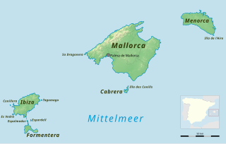
English: Map of the Balearic Islands
Deutsch: Karte der Balearischen Inseln |
| Date | |
| Source |
Travail personnel, using
|
| Auteur |
|
Conditions d’utilisation
Ce fichier est disponible selon les termes de la licence Creative Commons Attribution – Partage dans les Mêmes Conditions 2.0 Générique
- Vous êtes libre :
- de partager – de copier, distribuer et transmettre cette œuvre
- d’adapter – de modifier cette œuvre
- Sous les conditions suivantes :
- paternité – Vous devez donner les informations appropriées concernant l'auteur, fournir un lien vers la licence et indiquer si des modifications ont été faites. Vous pouvez faire cela par tout moyen raisonnable, mais en aucune façon suggérant que l’auteur vous soutient ou approuve l’utilisation que vous en faites.
- partage à l’identique – Si vous modifiez, transformez, ou vous basez sur cette œuvre, vous devez distribuer votre contribution sous la même licence ou une licence compatible avec celle de l’original.
Historique du fichier
Cliquer sur une date et heure pour voir le fichier tel qu'il était à ce moment-là.
| Date et heure | Vignette | Dimensions | Utilisateur | Commentaire | |
|---|---|---|---|---|---|
| actuel | 18 mars 2014 à 01:06 | | 1 503 × 955 (2,87 Mio) | Entbert | fix |
| 17 mars 2014 à 01:56 |  | 1 503 × 955 (2,86 Mio) | Entbert | fix | |
| 17 mars 2014 à 01:40 |  | 1 503 × 955 (2,86 Mio) | Entbert | == {{int:filedesc}} == {{Information |Description = {{en|1=Map of the Balearic Islands}} {{de|1=Karte der Balearischen Inseln}} |Source ={{own work}}, using *[http://www.openstreetmap.org/... |
Utilisation du fichier
Aucune page n’utilise ce fichier.
Usage global du fichier
Les autres wikis suivants utilisent ce fichier :
- Utilisation sur ca.wikipedia.org
- Utilisation sur de.wikipedia.org
- Utilisation sur de.wiktionary.org
- Utilisation sur frr.wikipedia.org
- Utilisation sur www.wikidata.org